|
GIS in Action Home Page
Below are some general details about the conference and a Map Gallery Contest. WHEN: The Conference will be held Tuesday, April 30 through Wednesday, May 1, 2024, with a pre/post-conference workshop on Monday, April 29, and Thursday, May 2. AT: The conference will be in downtown Portland at the Standard Insurance Building, home of Esri’s Portland R&D offices. The GIS in Action Conference has happened (almost) yearly for the last 32 years. There are many opportunities for students and instructors (like you) to interact with and share your work with other GIS professionals at the conference, including a Map Contest. MAP CONTEST: At the conference, I will be in charge of the Map Contest and would like to get as many contestants as possible. Could you tell your students about the conference and contest or possibly use a project in a class to be included in the contest? Here are the categories that a project can be placed in and some other details of the contest. CATEGORIES: • Analytic presentation - Communication of meaningful patterns in data • Cartographic - The quality of the visual display • Data Integration - Combining data from different sources • Web Applications – StoryMaps, ArcGIS Online, Tableau, Mapbox, Power BI, or Other • Student – Anyone enrolled in a class pursuing a degree or certificate In the student category, students will compete against other students. PRIZES: All conference attendees will be allowed to vote and will be given a ballot to vote for the best contest entries. Each category winner will receive a prize. In the past, prizes were $50 dollar gift certificates from REI. The second-place winners may also get a prize depending on how many people register for that category. HOW TO REGISTER: You can register for the Map Contest at this link: Register link here: Map Contest 2024 The format for contest entries can be hardcopy and/or digital maps, or web applications. Hard copy entries should be no larger than 3 ft by 5 ft to fit on the poster board. An astounding new topographic map of the world is now available with imagery free to researchers. “A pair of satellites operating in tandem for five years have produced a depth map of the planet so exact you could theoretically zoom down to street level and tell an adult from a kid, or spot a breaking wave at Malibu. The immense database — some 2.6 petabytes — is available for free to researchers.”
Join Portland's Tree Inventory Project! Volunteers needed to identify, map, and measure trees6/10/2015
50,000 trees. 20 neighborhoods.
We need you! Register today to participate! PP&R Urban Forestry is partnering with neighborhood tree teams to complete street tree inventories in 20 communities! This monumental undertaking is undertaken by volunteers who collect and process data on an estimated 50,000 street trees. We are seeking team leaders, data collectors, data entry, arborists, and tree team members. If you love trees, we have a role for you! 2015 inventory neighborhoods include Buckman, Centennial, Hazelwood, Irvington, King, Mill Park, Montavilla, Mt. Scott Arleta, N. Tabor, Old Town - Chinatown, Parkrose, Parkrose Heights, Powellhurst Gilbert, Roseway, Sabin, S. Portland, Sumner, Tabor, Vernon, and Woodlawn. For more details and to register visit: http://portlandoregon.gov/parks/treeinventory To see full opportunities to participate in this project: https://t.e2ma.net/message/4omdg/09j2wh  June 26, 2014
Portland, Oregon, USA Call for Maps!We invite contributions to the FOSS4G Map Galleryto build an exciting and vibrant exhibit of the very best in mapping. This Map Gallery will not only demonstrate the work of delegates but also act as a reference point for the current state of mapping more widely. We encourage all delegates to share one example of their work and help us create a cartographic record of the FOSS4G 2014 conference. Contributing to the FOSS4G Map Gallery is simple: make a map involving open source technology or open data, and share that map online! Details of the format and mechanism to share your work are provided below. Making your mapMake your map using whatever combination of technologies and data you choose. Your map can be the result of a commercial venture or a personal challenge. The map exhibit will feature work in digital form; your map may be a PDF or may be a fully interactive web map application. You will be asked to provide a short description of your map and a statement of the methods, software and data you used in your map design and production and you are also eligible to enter your map into one of the the various competition categories…yes, there are prizes up for grabs! The only other criteria for submitting your work is that it should have been created during 2012-2014. Submitting your mapThe submission form will open on June 26th and close on August 31st; that’s about eight weeks to pull together the projects you’ve been working with over the last year or more. You are encouraged to submit your application via the FOSS4G web site. Fame and glory!There are several optional competition categories, and each will be judged by a panel of independent experts. The winners of each category will be announced during the conference. There will also be a People’s Choice Map Prize. Delegates at the conference will be encouraged to explore the map exhibit during the conference and vote for their favorite map. The FOSS4G Map GalleryDuring the conference, submitted maps will be displayed in several ways. A digital map gallery will showcase work from all participants and delegates will be encouraged to visit the map exhibit and explore the entries. Maps will also be displayed throughout the venue on large format projected displays as well as be used in between sessions. Your maps will gain considerable exposure, and there may be no better way to network than being able to say “hey…that’s my map!” and start a conversation. http://us3.campaign-archive2.com/?u=92023a5676f520b1414335d36&id=962f2cdbd2&e=9c379cc5d4 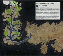 For those Carto-nerds/Game of Thrones fans out there. the entire history of Westeros told through maps:
http://imgur.com/a/GRIkN#0  An oldie but goodie. Dating back from 1998...
"Five ways of mapping the world. One story about people who make maps the traditional way - by drawing things we can see. And other stories about people who map the world using smell, sound, touch, and taste. The world redrawn by the five senses" http://www.thisamericanlife.org/radio-archives/episode/110/mapping  Penn State is offering Maps and the Geospatial Revolution MOOC (Massive Open Online Course), for the 2nd time starting 30 April 2014 and runs for 5 weeks.
Free! An excellent learning opportunity AND an excellent opportunity to meet new colleagues from all over the world! For short video explaining the objectives of the course and how to sign up: http://www.youtube.com/watch?v=bkd_rFgn5UQ&list=UUdShBEYmIgoDn34bi1vVA9w  New Release - U.S. Census Bureau International Population Data and Maps
The Census Bureau has added to and updated the online collection of subnational population data linked to maps (shapefiles) that are available at the Spatial Data Repository. The Repository contains a variety of data and maps primarily for countries that receive assistance via the President's Emergency Plan for AIDS Relief (PEPFAR). http://spatialdata.measuredhs.com/ To access the maps, start at the web page above and: 1. Click on Data in the ribbon below the title 2. Under the Select Countries tab at the left, click on Single Country 3. Choose a country in the dropdown menu immediately below the Single Country tab to see available data sets. Census Bureau population data and maps are available for the countries listed below. - Africa: Botswana, Ethiopia, Ghana, Kenya, Lesotho, Malawi, Mozambique, Namibia, Nigeria, Rwanda, South Africa, Tanzania, Zambia, Zimbabwe - Americas: Dominican Republic, Guyana, Haiti - Asia/Europe: Cambodia, India, Indonesia, Russia, Thailand In the near future, the Census Bureau will release a seamless global map containing population estimates for tens of thousands of subnational administrative areas globally. The website below contains links to other Census Bureau international data and map products, including gridded data sets containing population estimates for 100-meter cells for several countries. These are ideal for obtaining neighborhood-level population estimates. http://www.census.gov/population/international/data/mapping/  Great opportunity to get involved with a community project and to see how City of Portland is using maps & spatial data to develop plans for transportation.
OPEN HOUSE Thursday, March 13, 2014 Drop by anytime from 5 PM to 7 PM. Overview presentation at 6 PM. David Douglas High School North Cafeteria, 1001 SE 135th Ave The Portland Bureau of Transportation (PBOT) is developing the Division-Midway Neighborhood Street Plan to help improve local connectivity. We want to hear from you! Come to the open house and: ␣␣ Learn about existing conditions, needs, opportunities and constraints. ␣␣ Review potential new local street and pathway connections and improvements to existing connections. ␣␣ Tell us where better local streets and pathways are most needed and why. Tell us what is missing. NEXT STEPS: Evaluate the potential connections and propose a street plan to share this Spring. Then complete a plan by Summer 2014. ALSO FEATURED AT THIS OPEN HOUSE: ␣␣ Powell-Division Transit and Development Project - Effort to improve transit service and bring support- ing development and investment to the corridor. ␣␣ TriMet East Portland Transit Service Enhancement Plan. ␣␣ East Portland Access to Transit Project - project will build pedestrian and bicycle improvements. Download Open House invitation here.  Village Earth is now offering its Community-Based Mapping online course through Duke University. This is a continuing education course and not for academic credit, therefore, admission to the university is not required. This course may be taken on its own or may be counted toward the Certificate in Sustainable Community Development.
For more details or to register for the course by end of day March 5: http://villageearth.org/training-and-consulting/online/community-based-mapping This course covers the basic principles, theory, and ethics of mapping and its role in participatory learning and action as well as larger processes of integrated community-based development. Participants will learn some basic mapping functions including projecting GPS coordinates onto a map, downloading and projecting satellite images, creating features from aerial imagery, and basic use of an open source GIS program. The instructor, David Bartecchi, has worked on many community mapping projects with indigenous peoples all over the world especially in helping Native American tribes with strategic land planning. You may contact the instructor directly with questions at david@villageearth.org. www.linkedin.com/in/davidbartecchi |
Categories
All
Archives
March 2024
|
 RSS Feed