CHRISTINA FRIEDLE

Geospatial Jobs, Internships, events, news & More

  • Home
  • About Me
  • Courses
  • GIS Club
    • About Us
    • Don't be a Dangle!
    • Event Calendar
  • Resources
    • Data
    • Tools
    • Blogs
    • ArcGIS Install
  • Blog
  • Aventuras Colombianas

10/23/2018

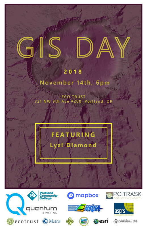
Come join us for our 7th annual GIS Day Celebration and a humanitarian mapathon! (Nov 14)

0 Comments

Read Now
 
GIS Day Social
What: Portland’s 7th Annual GIS Day Social
When: Wednesday November 14th, 6:00pm - 9:00pm
Where: Ecotrust, 721 NW 9th Ave #200, Portland, OR
RSVP at: http://meetu.ps/e/FYTmh/jRd2q/f (you’re also welcome to just show up!)

Please join us for Portland’s 7th Annual GIS Day Social! This year, we’ll gather in Ecotrust’s beautiful meeting space from 6pm - 9pm. The evening will feature:

  • A keynote from Lyzi Diamond, a geospatial expert and software engineer who is passionate about teaching people about maps and technology
  • Free pizza*, salad and beverages, courtesy of our generous sponsors
  • Plenty of social time to catch up with old geo friends and meet new ones
  • A raffle for some fun geo-prizes!

Students, professionals, and anyone interested in GIS and geospatial technologies are all welcome. This is a great opportunity to make some new professional connections and strengthen old ones, and we hope to see you there!

This event is volunteer run, and would be impossible without the generous support of our sponsors:

Gold level: Quantum Spatial
Silver level: ASPRS CRR, PCC, Ecotrust, OR-URISA, Mapbox
Bronze level: PDX OSGeo, Esri, Metro, PSU, DOGAMI, SCGIS, PC Trask

*Includes some gluten free, veggie, and vegan pizzas


GIS Day Missing Maps Mapathon
What: GIS Day Missing Maps Mapathon
When: Wednesday November 14th, 3:30pm - 5:30pm
Where: Portland State University, Geog Dept (exact room TBD)
Register at: https://www.meetup.com/OpenStreetMap-Portland/events/254936446/ (We are limited to 30 people, so sign up soon)

This year for GIS Day, use your geospatial skill to help people in vulnerable regions at this humanitarian mapathon! Madeline Steele of TriMet, a local OSM organizer, will lead the group, and we have booked a room at PSU with 20 computers and space for 10 laptops. It’s a great chance to do some good, learn about OSM, and meet a few like-minded mappers. If you can, please also join us for the GIS Day evening social at Ecotrust at 6pm. Details on that are here:

Background on the Missing Maps project from the Red Cross
Each year, disasters around the world kill nearly 100,000 and affect or displace 200 million people. Many of the places where these disasters occur are literally 'missing' from any map and first responders lack the information to make valuable decisions regarding relief efforts. Missing Maps is an open, collaborative project cofounded by the American Red Cross. It aims to put 200 million people "on the map" by 2021 - mapping areas where humanitarian organizations like the Red Cross are trying to meet the needs of vulnerable people. Due to current disasters and rapidly-changing needs, the November 15th Missing Maps tasks will be identified on or around November 1.
http://www.missingmaps.org/
Picture

Share

0 Comments


Leave a Reply.

Details

    Archives

    March 2023
    February 2023
    January 2023
    December 2022
    November 2022
    October 2022
    September 2022
    August 2022
    July 2022
    June 2022
    May 2022
    April 2022
    March 2022
    February 2022
    January 2022
    December 2021
    November 2021
    October 2021
    September 2021
    August 2021
    July 2021
    June 2021
    May 2021
    April 2021
    March 2021
    February 2021
    January 2021
    December 2020
    November 2020
    October 2020
    September 2020
    August 2020
    July 2020
    June 2020
    May 2020
    April 2020
    March 2020
    February 2020
    January 2020
    December 2019
    November 2019
    October 2019
    September 2019
    August 2019
    July 2019
    June 2019
    May 2019
    April 2019
    March 2019
    February 2019
    January 2019
    December 2018
    November 2018
    October 2018
    September 2018
    August 2018
    July 2018
    June 2018
    May 2018
    April 2018
    March 2018
    February 2018
    January 2018
    December 2017
    November 2017
    October 2017
    September 2017
    August 2017
    July 2017
    June 2017
    May 2017
    April 2017
    March 2017
    February 2017
    January 2017
    December 2016
    November 2016
    October 2016
    September 2016
    August 2016
    July 2016
    June 2016
    May 2016
    April 2016
    March 2016
    February 2016
    January 2016
    December 2015
    November 2015
    October 2015
    September 2015
    August 2015
    July 2015
    June 2015
    May 2015
    April 2015
    March 2015
    February 2015
    January 2015
    December 2014
    November 2014
    October 2014
    September 2014
    August 2014
    July 2014
    June 2014
    May 2014
    April 2014
    March 2014
    February 2014
    January 2014
    December 2013
    November 2013
    October 2013
    September 2013
    August 2013
    July 2013
    June 2013
    May 2013
    April 2013
    March 2013
    February 2013
    January 2013
    December 2012
    November 2012
    October 2012
    September 2012
    August 2012
    July 2012
    June 2012
    May 2012
    April 2012
    March 2012
    February 2012
    January 2012
    December 2011
    November 2011
    October 2011
    September 2011
    August 2011
    July 2011
    June 2011
    May 2011
    April 2011
    March 2011
    February 2011
    January 2011
    December 2010
    November 2010
    October 2010
    September 2010
    August 2010
    July 2010
    June 2010
    May 2010
    April 2010
    March 2010
    February 2010
    January 2010
    December 2009
    November 2009
    October 2009
    September 2009
    May 2009
    April 2009

    Categories

    All
    Aag
    Americorps
    Animations
    Applied GIS
    Applied Gis
    Apps
    Article
    Articles
    Asprs
    Books
    Careers
    Cartography
    Competition
    Conferences
    Conservation
    Diaster Mapping
    Drones
    Environmental
    Esri
    Events
    Fellowships
    Games
    Geoapp
    Geographic Awareness
    Geography
    Geomatics
    Geospatial Technologies
    GIS
    GIS Data
    Gis Data
    GIS Day
    GIS Day
    GIS Resources
    Gis-resources
    Google
    Google Earth
    Google Maps
    Gps
    Graduate School
    Grants
    Happy Hour
    Happy Hours
    Humor
    Hydrology
    International
    Internships
    Interviews
    Job
    Jobs
    Journals
    Lecture
    Lidar
    Maps
    Meeting
    National Geographic
    Natural Resources
    Open Source
    Oregon
    PCC
    Podcast
    Porland
    Portland
    Presentations
    Professional Development
    Professional-development
    Projections
    Raster
    Remote Sensing
    Research
    Scgis
    Scholarships
    Social Networks
    Software
    Songs
    STEM
    Story Maps
    Study Abroad
    Surveying
    Technical Help
    Tools
    Training
    UAS
    UAV
    University
    Urban Design
    Videos
    Visualization
    Webinar
    Web Mappping
    Websites
    Women In GIS
    Workshops

    RSS Feed

Contact ME

  • Home
  • About Me
  • Courses
  • GIS Club
    • About Us
    • Don't be a Dangle!
    • Event Calendar
  • Resources
    • Data
    • Tools
    • Blogs
    • ArcGIS Install
  • Blog
  • Aventuras Colombianas