|
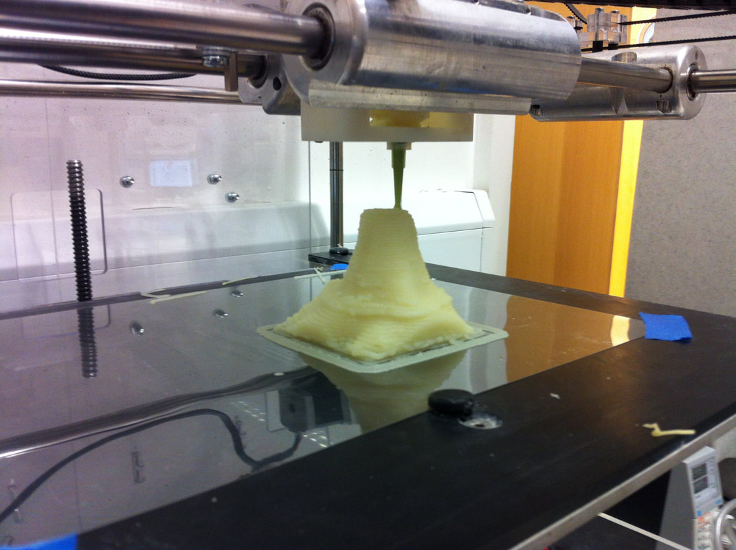
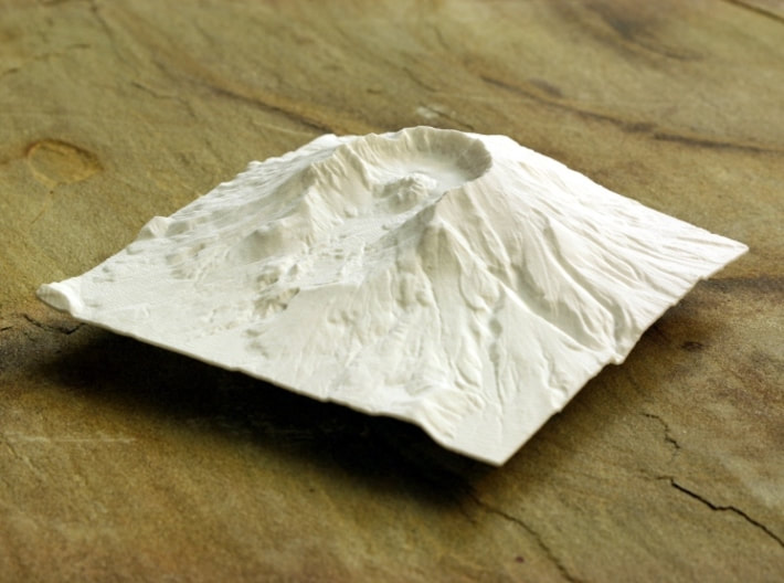
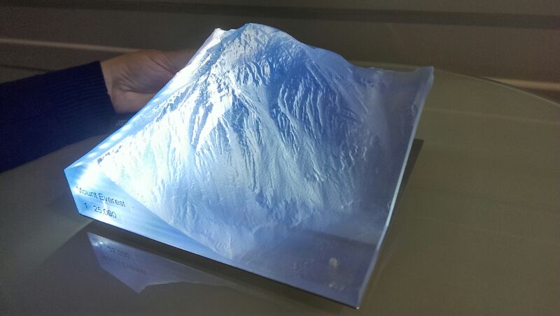
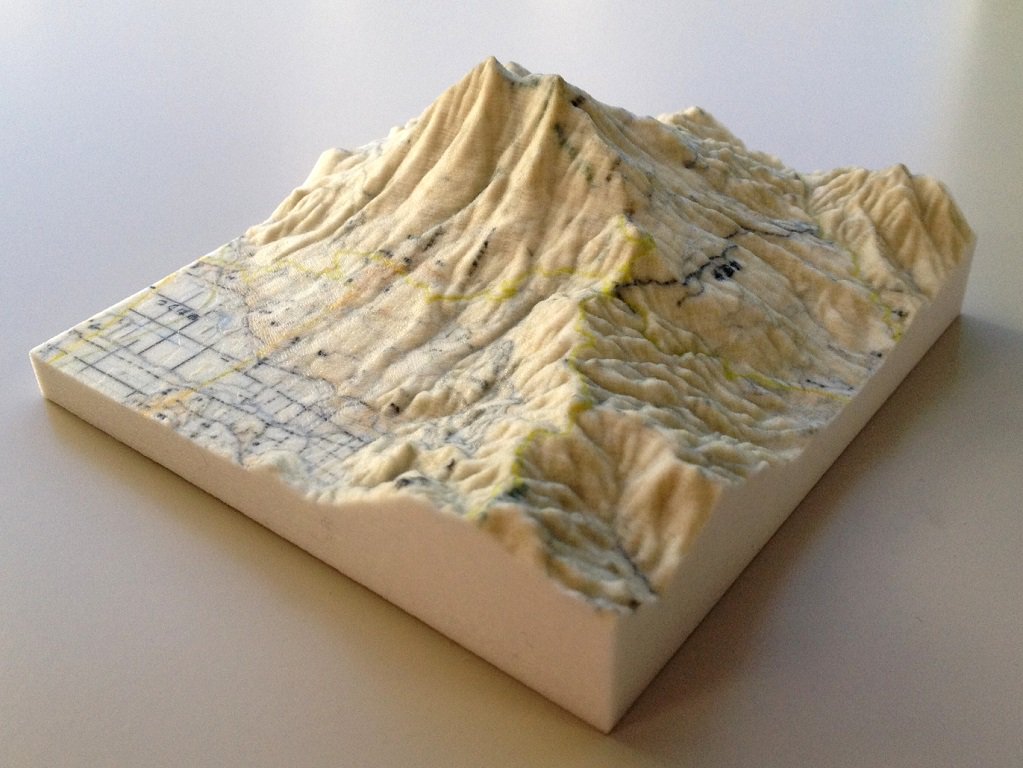
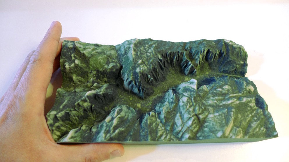
Written by Doug Moak When I first read of 3D printing, Discover magazine reported on a “3D fax machine.” A point file was transmitted over phone lines, resulting in a transparent print of a simian skull. The article went on to proclaim that stereolithography would replace the copious backstocks of spare parts in manufacturing facilities, repair shops, and aircraft carriers; I refused to believe that scenario as a possibility. Now that possibility is the new normal, and I was dead wrong. Stereolithography is primarily manifested in polymer resin excited by a laser, with a hobbyist’s market in desktop rapid prototype machines and websites dedicated to sharing data files that result in robot hands or Baby Groot. The bulk of the individual product are knick-knacks. 3D printing can be used for analytical purposes by virtue of miniaturized models used for study. Of the many things I was not aware of in the field of geospatial analysis is the use of raster data to produce 3D prints of natural features. Aside from nice things to place on the desk or gather dust on a shelf, these products can be used for analysis such as avalanche study, weather modeling, search and rescue, and excursion planning. There are a couple of different ways- a raster DEM can be converted to a triangulated irregular network (TIN) file, processed through TIN Extrude Between, Decimate TIN Nodes, and Multipatch To Collada tools, then conversion to .STL using a third party Mashlab program, such as this unnamed author. Another way is to feed a DEM into Accutrans 3D, which is a pay-to-use program, explained here. These processes have been used to produce 3D prints of Mt St. Helens, Yosemite Valley, and an accurate model of Devils Tower-out of mashed potatoes. The possibilities are not limited to exterior natural features. When my friend Clarence was sent through caves at the foot of most of the Cascade’s stratocones with a LiDar package strapped to his back, he produced point clouds that could be processed into accurate cutaway models, enabling close study of cave features by researchers who are nowhere near these caves. These are just two ways to create tangible representations of spatial data using raster files that are usually readily available online, using processing applications that we are familiar with.
6 Comments
JJB
6/3/2018 11:53:46 am
Thanks for the summary of turning DEM to TIN to *.stl and further resources to check out. I am very interested in using small UAVs to turn filmed data into 3D models, for an instance check out Pix4D mapper and how folks are 3D modeling from pictures and video. This is a pretty interesting future we're headed toward.
Natalie Divine
6/4/2018 11:22:04 am
Cool! I know the Maker's Lab at PCC has 3D printers, I wonder if they have the other requirements. I really liked seeing the step-by-step process in the story map that you linked to at the end. "Let's have a fun digital fabrication with ArcGIS!"
bob nicholas
6/12/2018 02:30:45 pm
Last Sunday afternoon, I was in the Makers Hub at the Eugene Public Library watching some kids print out costume pieces on these 3D printers. They kind of look like a hot glue gun with plastic filaments that melt at 210 degrees. Each machine can accept three filaments so it can do three colors. At the time I thought, I'll bet someone is using these things for GIS. I happened to be wearing a PCC t-shirt, and the man in charge there pointed out that we have an open makers space here at Sylvania in the basement of the automotive building. When I got back to my motel, I turned on my laptop and there is your post about 3D printing. Weird world. 2/4/2023 04:53:06 am
Excellent article! Thank you for your excellent post, and I look forward to the next one. If you're seeking for discount codes and offers, go to couponplusdeals.com. Leave a Reply. |
AuthorBlog posts are written by students in the Interactive Map Design course at Portland Community College. Archives
June 2018
Categories |
 RSS Feed