CHRISTINA FRIEDLE
  • Home
  • About Me
  • Courses
  • GIS Club
    • About Us
    • Don't be a Dangle!
    • Event Calendar
  • Resources
    • Data
    • Tools
    • Blogs
    • ArcGIS Install
  • Blog
  • Aventuras Colombianas

5/9/2016

Citizen Science-A Researcher’s Aide

2 Comments

Read Now
 
Picture
Written by Kat Perez

In a world rampant with mobile smart phones-essentially, portable, data collecting devices-data processors have more random data than ever before. So, if data collection has never been easier, why not control the data by asking users for exactly the information you are looking for? Enter citizen science. Rather than spending time, money and energy collecting data to answer questions, researchers are turning to, well, a lot of people.
 
According to the PEW Research Center, the global average of reported smart-phone ownership is 43%. The majority of this smart-phone toting population lives primarily in developed nations, so this demographic skew should be remembered and accounted for when attempting to utilize citizen science globally.
 
If you want to utilize this strategy, you need to do the following:
  • Determine what question it is you want to answer-exactly. What data do you need and how does it need to be collected and formatted to be accurate and easy to gather. Also,    determine that this data will be easily visualized geospatially.
  • Identify your users. What audience will most likely be gathering data for you. Are they       experts in the field? Have a geospatial background?
 
What is required, is websites that are easy to utilize and mobile apps that are simple to comprehend and collect accurate data with, without requiring the user to be an expert in the field of interest or geospatial concepts. The intricacies associate with geospatial data such as projections, datums, time-space etc. will likely have to be accounted for by the web-map maker.
 
The following are recommendations for creating a system that incorporates citizen science efforts and mobile-app data entry:
  • Communicate the purposes of the website and the roles they support.
  • Build features for both project managers and volunteers and clearly separate them.
  • Develop customizable data entry forms that ensure data quality, yet remain simple.
  • Create simple map applications that visualize accuracy, precision, and uncertainty.
  • Add information to help with map interpretation (improve cognitive access).
  • Provide a cursory understanding of spatial concepts through online help.
  • Create transparent features that are used and explored by volunteers and volunteer coordinators; avoid limited black box systems (Merrick 2003).
  • Provide rich content even in the absence of user-contributed web content.
  • Incorporate communication features (e.g., training; data collection, entry, dissemination, and analysis; and communication from scientists back to volunteers).
  • Create online questionnaire creation and delivery tools similar to Survey Monkey to better integrate user feedback, participation, and program evaluation
Source: Newman, 2010
 
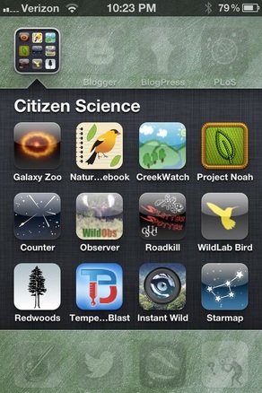
Go to the link below to view some AWESOME examples of mobile apps that utilize citizen scientist to collect data:
http://www.scientificamerican.com/article/8-apps-that-turn-citizens-into-scientists/


​Sources:
  • Merrick, M., 2003. Reflections on PPGIS: a view from the trenches. Journal of the Urban and
Regional Information Systems Association , 15 (APA II), 33–39.
  • Newman, G., 2010. User-friendly web mapping: Lessons from a citizen science website (PDF Download Available). Available from: https://www.researchgate.net/publication/220650268_User-friendly_web_mapping_Lessons_from_a_citizen_science_website [accessed May 6, 2016].
  • PEW Research Center., 2016. Smartphone-ownership-and-internet-usage-continues-to-climb-in-emerging-economies. http://www.pewglobal.org/2016/02/22/
  • Image: www.openscientist.org


Share

2 Comments
Daniel Schick
5/29/2016 09:41:08 pm

The problem with citizen science it centers on the cat-herding dynamic, in which getting a large group of people to follow simple instructions is the equivalent of herding cats. However, we cannot simply blame volunteers for not following instructions when the researcher does not provide proper guidance. Depending on the study and methods of recording there can be a disconnect between when the incident was reported and how it was transcribed. It similar to a game of telephone, the message can start out as “there are four lights”, and end up as Captain Picard is a Federation spy. Luckily, in our app and GIS centric age we can create digital methods of recording that are so simple that even the most earnest of technophobes will be able to use them. We still might have a problem with accurate gps locations, but that’s a topic for another day.

Reply
Robert Mannering
6/2/2016 02:27:47 pm

Someone needs to forward this to Peter Ditson at SWAMP. Post haste.

Reply


Leave a Reply.

Details

    Author

    Blog posts are written by students in the Interactive Map Design course at Portland Community College.

    Archives

    June 2018
    May 2018
    April 2018
    June 2017
    May 2017
    April 2017
    June 2016
    May 2016
    April 2016

    Categories

    All
    GIS
    QGIS

    RSS Feed

Contact ME

  • Home
  • About Me
  • Courses
  • GIS Club
    • About Us
    • Don't be a Dangle!
    • Event Calendar
  • Resources
    • Data
    • Tools
    • Blogs
    • ArcGIS Install
  • Blog
  • Aventuras Colombianas