Oregon Health Authority, Environmental Public Health Tracking
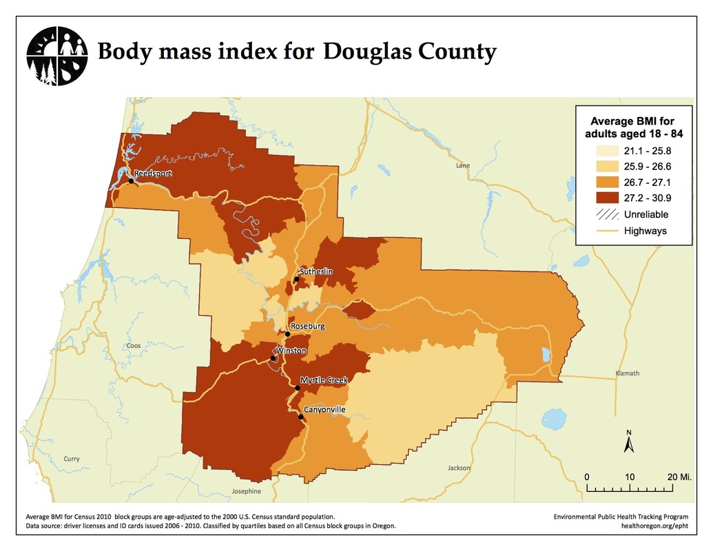
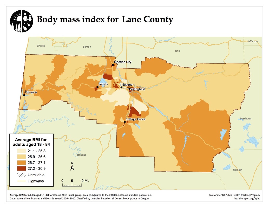
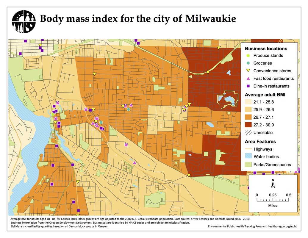
Laura Rose worked with the Environmental Public Health Tracking (EPHT) epartment to create state, county, and city level maps throughout Oregon to show obesity rates using Body Mass Index (BMI) data. The project is intended to help government and community health workers visualize obesity issues in their areas; examine and identify risk factors, socio-economic, or food-access differences within populations; and create education opportunities around obesity data throughout the state. Below are three examples of these maps, although a total of over 50 maps were created for the project.
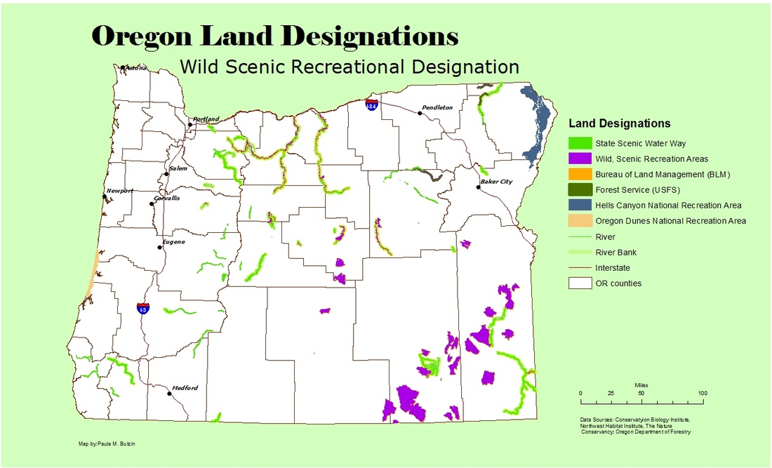
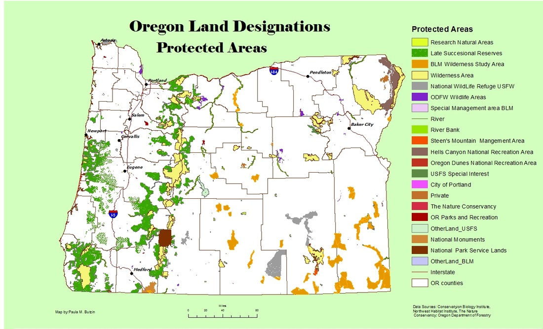
Atlas of Oregon
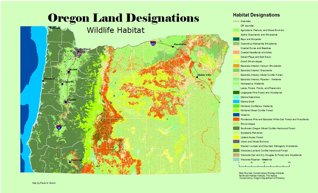
In 2001. The University of Oregon Press released a comprehensive Atlas of Oregon. More than a decade later, these maps are getting out of date. Paula Butzin worked with PCC Geography Instructor, Matt Constantino, to update and recreate a series of these maps for the Geography of Oregon class. A total of six maps were created - below are three of those.
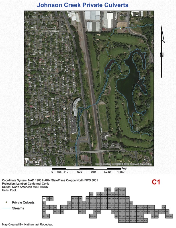
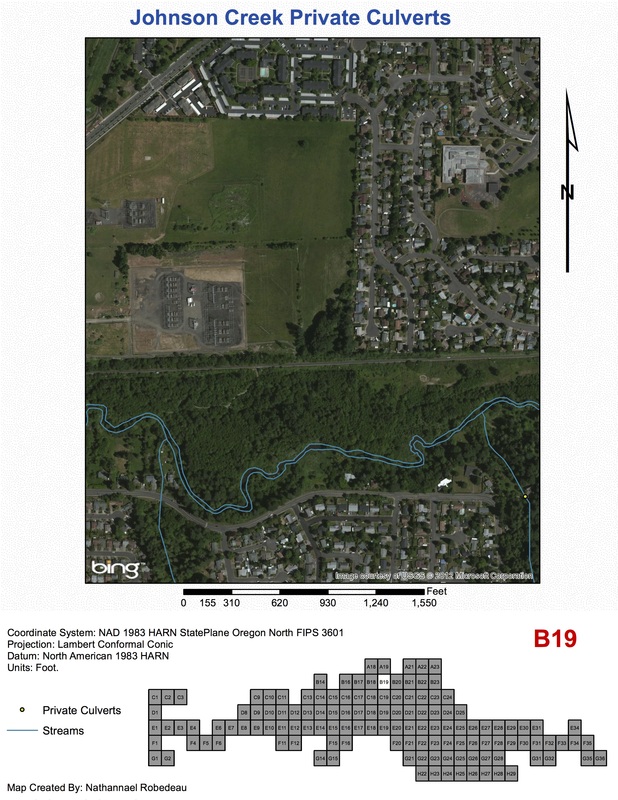
Johnson Creek Watershed Council
Nate Robedeau worked with the Johnson Creek Watershed Council to identify, rate, and map out culverts within the Johnson Creek Watershed. The goal of the projects was to better understand fish passage barriers in the watershed and to prioritize restoration efforts on culverts in both public & private lands. The final product was a map book that allows you to see a large geographic area, broken down into small segments. Below are a few sample pages from the Culvert Map Book.

PCC -Rock Creek Botany Tour, Spring 2012
The primary goal of this project, lead by Whit Bouton, was to create a walking tour map and virtual environment of the Botany at PCC Rock Creek campus to serve as a resource for students, faculty and community. Think of it as a virtual field guide that brings you to the plants on campus. Watch the video below to get an overview of the project.
Tryon Creek Watershed Council, Spring 2012
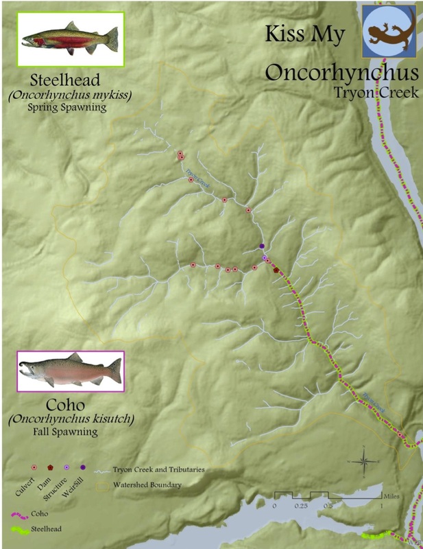
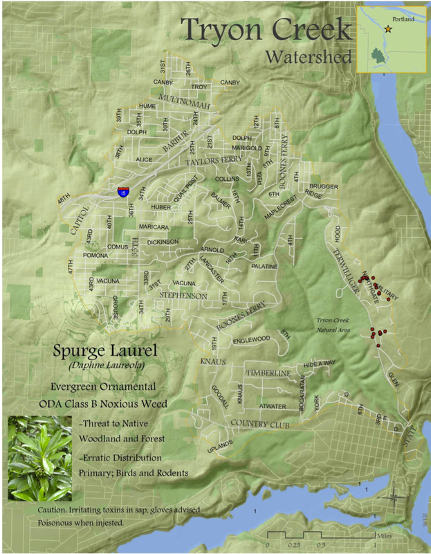
Both Elias Brown and Chris Weaver worked with the Tryon Creek Watershed Council to complete GIS projects. Elias's efforts focused more on data compilation, acquisition, and modification for the watershed council to use on a variety of GIS mapping projects. From this effort, Elias was able to produce maps on Spurge Laurel, spawning fish, and greenspaces within the watershed.
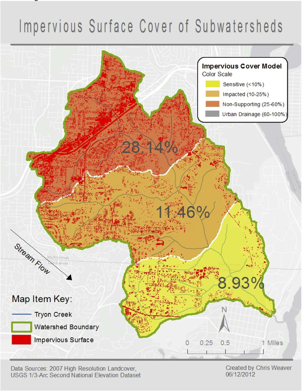
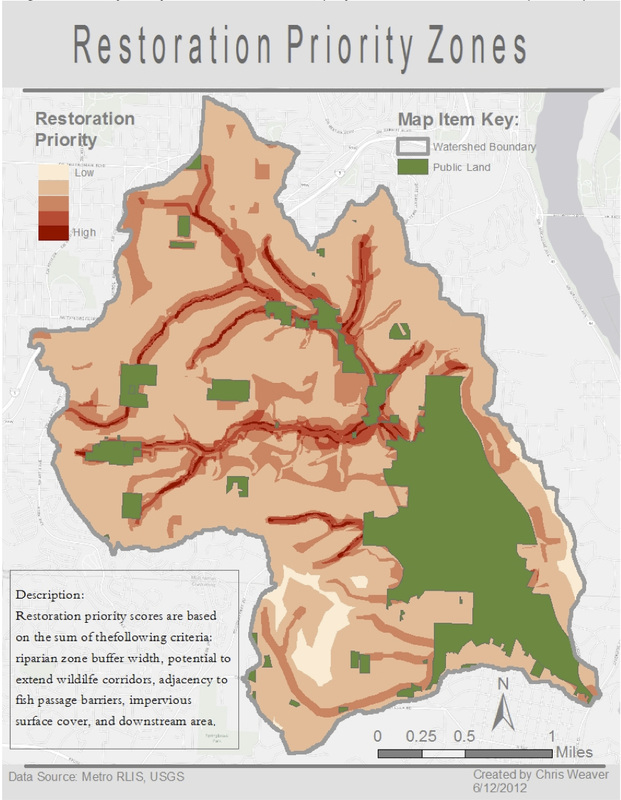
Chris completed a GIS analysis to prioritize potential restoration locations within the watershed. This was done by looking at impervious surface, adjacency to known fish barriers, riparian buffer zones, affected downstream area, and potential for wildlife corridors.
Chris completed a GIS analysis to prioritize potential restoration locations within the watershed. This was done by looking at impervious surface, adjacency to known fish barriers, riparian buffer zones, affected downstream area, and potential for wildlife corridors.
PCC Habitat Team, Spring 2012
Sean Payne worked with PCC's Habitat team to create a Google Earth tour of the Sustainability sites on campus. Some of the sites highlighted in the tour include the rain garden, worm bins, windmill, and community garden, among others. The project is still in the final phases of completion. Below you can download the .kmz file for Google Earth to see the work in progress.
| sustainabilitysites.kmz |
OpenStreetMap Projects, Spring 2012
Two students chose to focus their projects on gathering and contributing data for OpenStreetMap. OpenStreetMap is a free, worldwide map created in a wiki format - by the people. You can download the data for free, and anyone with a (free) account can contribute data to the map. Here are shots showing the before and after shots of their contributions.
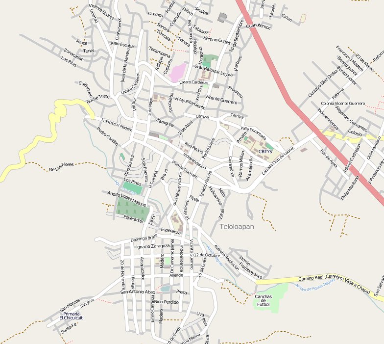
Teloloapan, Mexico - completed by Huitzi Rios-Martinez
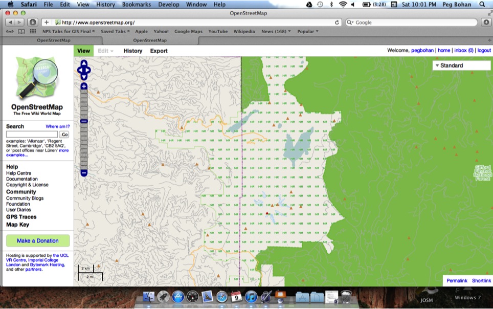
Mt. St. Helen's - completed by Peg Bohan.
Teloloapan, Mexico - completed by Huitzi Rios-Martinez
Mt. St. Helen's - completed by Peg Bohan.

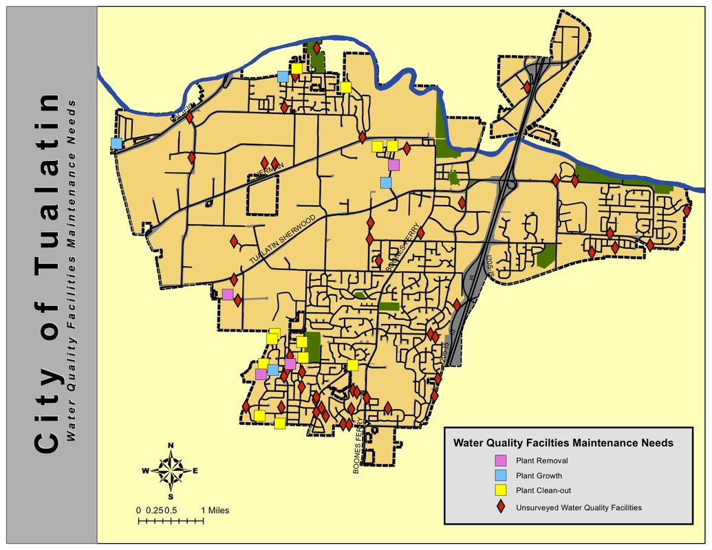
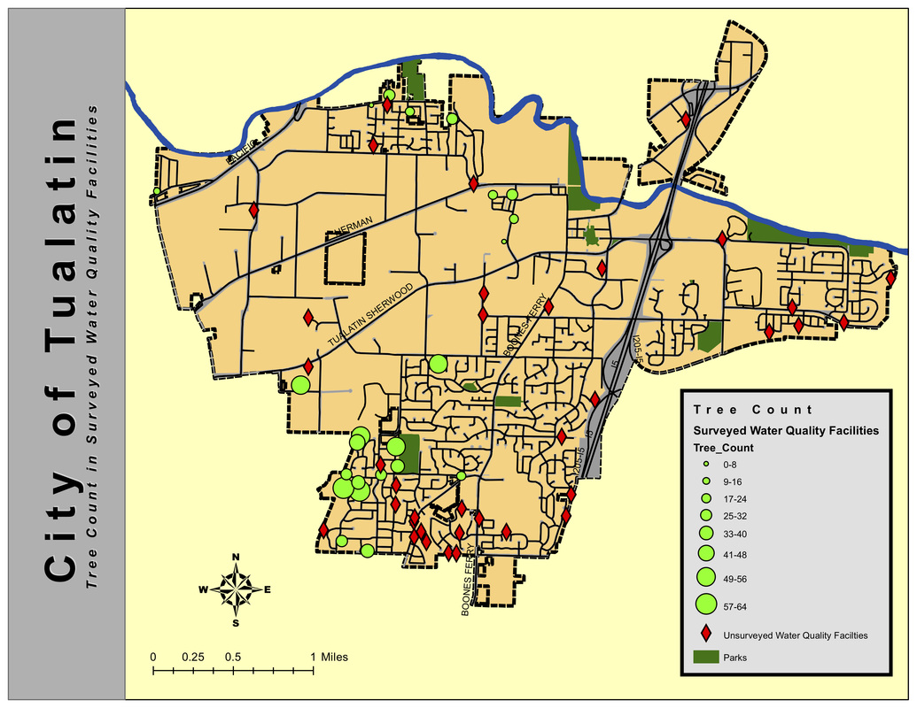
City of Tualatin, Spring 2012
Jonathon Albano and Chai Saechao both worked with the City of Tualatin to survey, collect data, and map various aspects of the city's trees in parks and water quality facilities. The goal of the projects was to assess the general health of trees throughout the city.


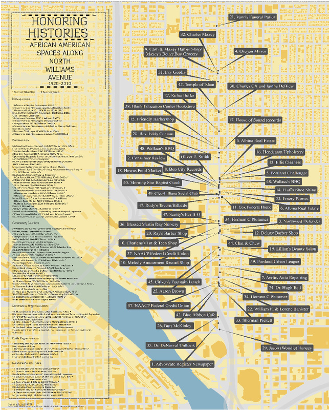
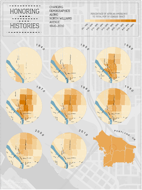
North Williams Traffic Operations Safety Project, Spring 2012
The purpose of this project was to identify and map historic African-American businesses, home and community organizations along North Williams Ave in Portland. Dirk Kinsey worked with this organization to create two maps (and Google Earth files). The Honoring Histories map shows potential locations for the Honoring Histories installation project, and locations that have been identified as historically significant places along N. Williams. The second map shows the demographic changes in the Albina neighborhood from 1940 to 2010.
  |
| ||
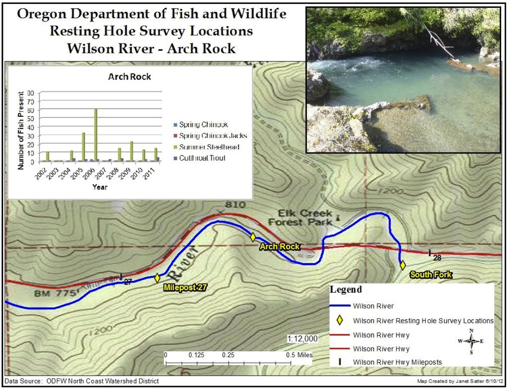
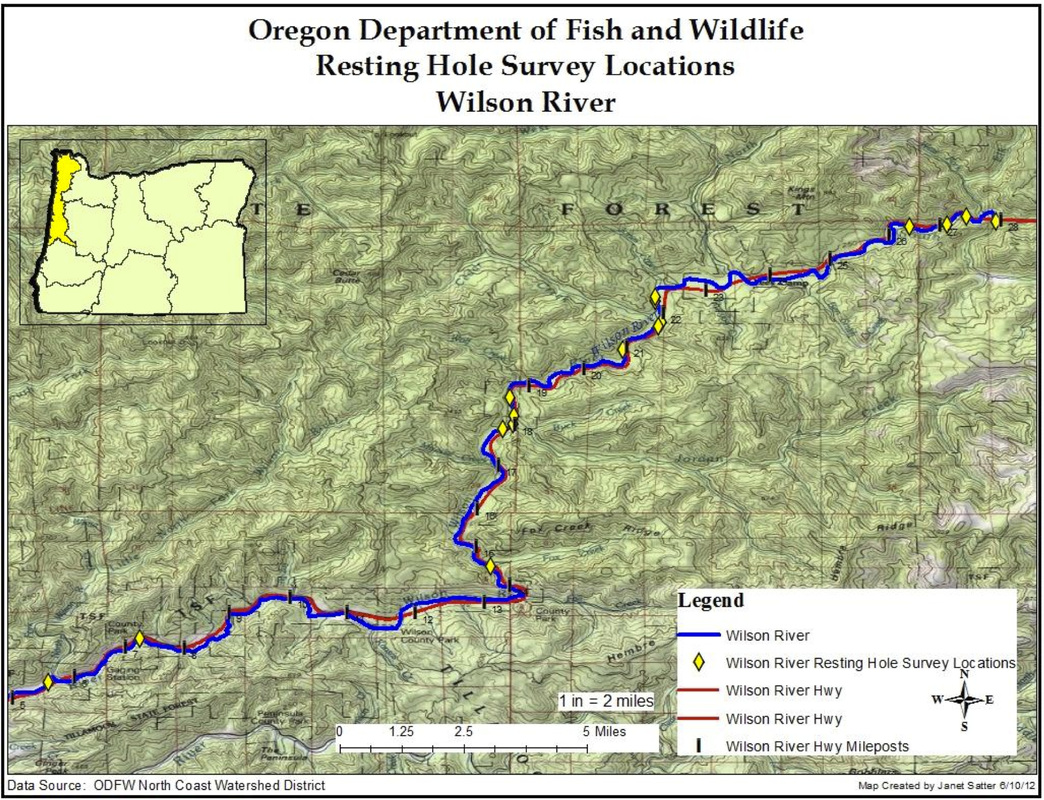
Oregon Dept of Fish & Wildlife, Spring 2012
This project was completed by Janet Satter with the USFW's North Coast Watershed District. The project focused on surveying 16 fish resting holes along the Wilson River to create a Google Earth tour. The tour highlights the resting holes and also shows photographs, as well as bar graphs indicating the number of each species of fish observed at the site for the last ten years.
  |
| ||