|
Written by Kayla Tomlin Have you seen a UFO? And if you did, what would you do about it? MUFON (Mutual UFO Network) is a scientific research organization that conducts scientific investigation of UFO’s for the benefit of humanity. They host a clever map that shows UFO sightings from all over the world, and allows you to enter your own sighting along with supporting evidence like photos, drawings and videos. I spoke with Tom Bowden, the Oregon State Director of MUFON (Mutual UFO Network) to ask him a few questions about the interactive map and who created it. He said they hired an organization called UFO Stalker to make their map, and admitted that geolocating these anomalies can be problematic. Many people may not know their exact location during the sighting, much less the exact location of the UFO. If they don’t know what city they are in it could be recorded by county, state/region/province, or they may only know they saw a UFO in Paraguay! Here’s a shot of the map that has some fun interactive features that show the point data as UFO’s of various types (saucer, black triangle, or an alien face for alien encounters!) falling from the sky when you pan and zoom. There are popups that display a summary of the sighting, as well as a table summary below the map of the sightings within the view. 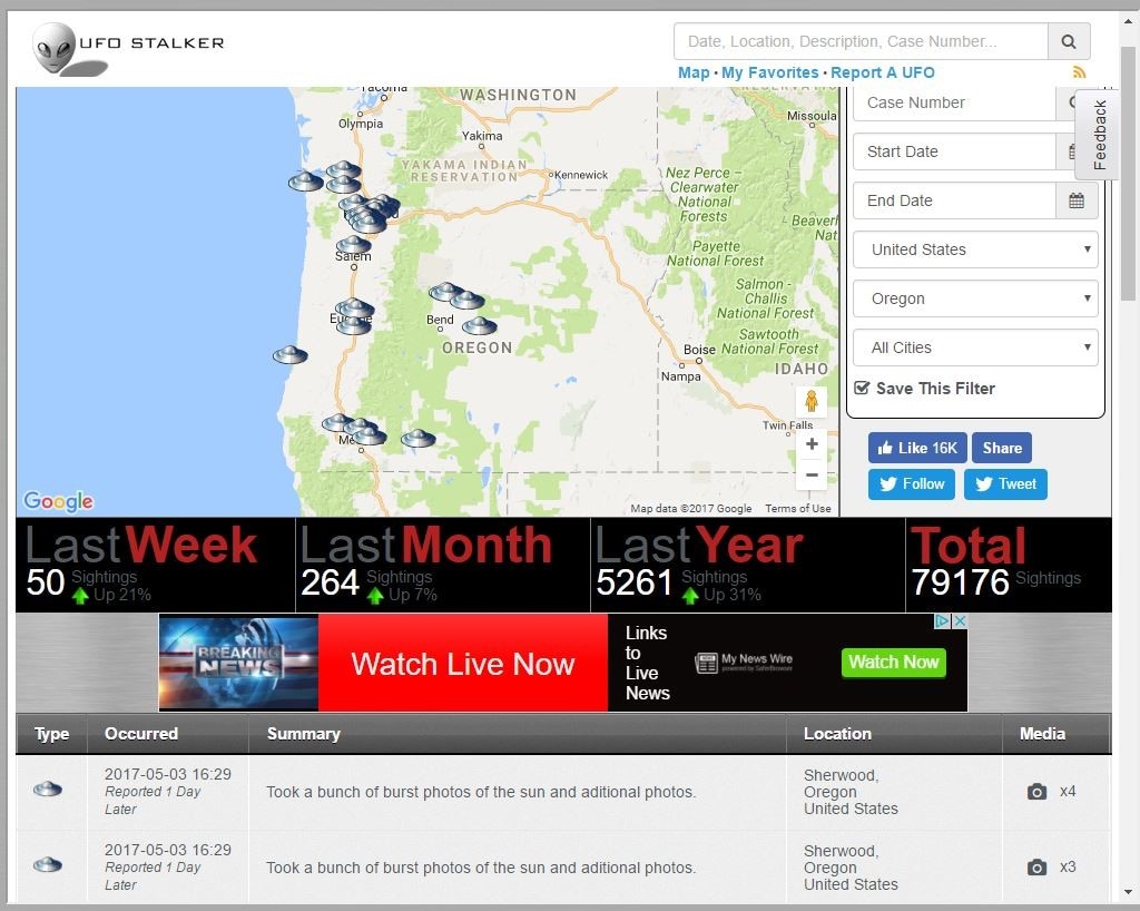  There is also a search feature that lets users search for sightings by date, location, or MUFON case number. I got ahold of the author of the map and his name is Douglas Bell, but he lets me call him Doug. Doug saw a “data source that was ripe for visualization” when he offered to create this map for MUFON, but Doug has admitted he has never actually seen a UFO himself. He appended the MUFON data to include additional statistics such as local weather conditions at the time of the sighting, and through his analysis he reports there are distinct patterns that have emerged. He said one clear trend is the fact that highest volume of UFO’s sightings occur on days when everyone is outside looking up on July 4th and January 1st.
Doug describes how he created the map using AngularJS and JQuery, Google Maps with custom overlays, and a Java API that serves the data to the presentation layer via Tomcat. Behind the scenes there are Java microservices that handle actions like data collection, correlation, and tweeting. His data sources come from a MySQL database, with local data stored on a Mongo database for caching and speed. Doug has created other interesting maps including one that geolocates IP addresses to aid police in locating stolen computers, a housing map that mines data from sources like Craigslist and Oodle allowing the user to search by amenities, as well as a garage sale and Wi-Fi hotspot locator for use on iPhone/Androids. If anybody could find aliens, it’s Doug. It’s just this type of inquisitive and talented mind that will make up the alien hunters of the future. These emerging UFO datasets could reveal the secrets that Giorgio Tsoukalos would kill for. Don’t forget to look up! http://www.mufon.com/live-ufo-map.html
4 Comments
Sarah Dewees
5/8/2017 11:14:47 pm
Kayla
Kayla Tomlin
5/14/2017 01:31:28 pm
No he didn't offer any links. This is a massive data base and I think it's size and "live" status makes things much more difficult with lots of need for speed and caching for performance. It is a worldwide map, which seems like a lot of work just to maintain.
Adele Rife
5/16/2017 12:38:57 pm
Haha, this is so cool! Doug sounds awesome.
eddie
5/28/2017 02:15:42 pm
I don't believe in alien sightings frankly but I think it's great someone is actually attempting to map them. Garage sale app is I think my favorite map idea I've heard this year. Leave a Reply. |
AuthorBlog posts are written by students in the Interactive Map Design course at Portland Community College. Archives
June 2018
Categories |
 RSS Feed