|
https://careers-nv5.icims.com/jobs/7607/survey-field-technician/job
Overview WHPacific, Inc., d/b/a NV5 is seeking a Survey Field Technician to join our Meridian team NV5 is a leader in providing surveying, civil engineering (transportation – roadway & bridge and land development), water resources and planning services with multiple offices in the Western United States. The person in this position assists professional land surveyors by operating survey instruments and collecting information in the field and by performing computations and drafting in the office. This is primarily a field Survey Technician Position but could also involve some substantial related duties in the office including Civil3D / MicroStation mapping. Responsibilities
Qualifications To perform this job successfully, an individual must be able to perform each essential duty satisfactorily. The requirements listed below are representative of the knowledge, skill, and/or ability required. Reasonable accommodations may be made to enable individuals with disabilities to perform the essential functions.
PHYSICAL DEMANDS The physical demands described herein are representative of those that must be met by an employee to successfully perform the essential functions of this job, dealing effectively and reasonably with stress in the workplace without lost time or undue strain. While performing the duties of this job, the employee is frequently required to sit, walk and talk or hear. Specific vision abilities required by this job include close vision, distance vision, color vision, depth perception, and the ability to adjust focus. Employee may be asked to walk on uneven surfaces, lift and carry up to 50 pounds, hike up and down steep slopes carrying up to 50 pounds of survey equipment, bend, squat, dig monument holes, pound in stakes and rebar monuments, carry and use brush cutting equipment, operate UTV’s / ATV’s, climb stairs, sit for extended periods of time, work at a computer terminal for extended periods of time, and type/key-in data as needed. The employee will be required to adhere to the company’s policies, safety plan and the project safety plan. NV5 offers a competitive compensation and benefits package including medical, dental, life insurance, PTO, 401(k) and professional development/advancement opportunities. https://careers-nv5.icims.com/jobs/7707/geotechnical-technician-i/job
Overview NV5 (NASDAQ: NVEE) is a provider of engineering and consulting services to public and private sector clients, delivering solutions through six business verticals: Testing, Inspection & Consulting; Infrastructure; Utility Services; Environmental Health Sciences; Buildings & Program Management; and Geospatial Technology. With offices nationwide and abroad, NV5 helps clients plan, design, build, test, certify, and operate projects that improve the communities where we live and work. As engineers, architects, construction/program managers, environmental professionals and beyond, we play a significant role in shaping our communities through the services we provide. We are looking for passionate, driven individuals to join our team focused on Delivering Solutions and Improving Lives. GeoDesign's Wilsonville, Oregon office is seeing a regular, full-time field technician for a variety of geotechnical projects in the Portland Metro area markets. Responsibilities
Although our core hours are generally 8 am to 5 pm Monday through Friday, it is sometimes necessary to work outside these hours to meet our client’s needs. Qualifications Education
https://careers-nv5.icims.com/jobs/7684/remote-sensing-technician/
Overview NV5 is a provider of engineering and consulting services to public and private sector clients, delivering solutions through six business verticals: Testing, Inspection & Consulting; Infrastructure; Utility Services; Environmental Health Sciences; Buildings & Program Management; and Geospatial Technology. With offices nationwide and abroad, NV5 helps clients plan, design, build, test, certify, and operate projects that improve the communities where we live and work. As engineers, architects, construction/program managers, environmental professionals and beyond, we play a significant role in shaping our communities through the services we provide. We are looking for passionate, driven individuals to join our team focused on Delivering Solutions and Improving Lives. NV5 offers a competitive compensation and benefits package including medical, dental, life insurance, PTO, 401(k) and professional development/advancement opportunities. Description The Remote Sensing Technician (RST) acquires airborne and Geodetic ground survey data. The RST is a field based position that collects aerial survey data with topo and bathymetric LIDAR as well as thermal, hyperspectral, and multispectral imagery sensor systems throughout North America. Alternatively, the RST will be collecting ground data using GNSS survey tools, water monitoring tools, thermal loggers, spherical camera, and mobile LIDAR mapping systems. In the aerial application the RST’s work closely in a collaborative team environment with a captain in small aircraft/helicopters while flying acquisition missions. When collecting control on the ground, the RST will work in a solo environment in remote locations. Examples of collection areas would be urban roads, deep forest, mountainous, agriculture, and riverine environments. RST's configure and monitor sensor systems, track acquisition progress, download/process/ship geospatial datasets to production offices. Responsibilities
Qualifications Minimum Qualifications
Preferred Qualifications
This position reports to the acquisition management team with primary hangar and survey locations in Oregon, Wisconsin, and Virginia. This position will function as a remote position but the employee is responsible for transportation to a medium or large hub primary commercial airport at which point company provides onward travel to and from work locations throughout North America. This position is included in the company’s hearing conservation program. All job offers with NV5 Geospatial are contingent upon passing a background check and drug screening. NV5 provides equal employment opportunities (EEO) to all applicants for employment without regard to race, color, religion, gender, sexual orientation, gender identity or expression, national origin, age, disability, genetic information, marital status, amnesty, or status as a covered veteran in accordance with applicable federal, state and local laws. NV5 complies with applicable state and local laws governing non-discrimination in employment in every location in which the company has facilities. This policy applies to all terms and conditions of employment, including, but not limited to, hiring, placement, promotion, termination, layoff, recall, transfer, leaves of absence, compensation, and training. We are excited to announce that Business Oregon is recruiting for one full time GIS Analyst (Information Systems Specialist 7).
The recruitment opened on Wednesday, February 8, 2023 and will close on Tuesday, February 21, 2023. Recruitment Link Job Description: Business Oregon is currently hiring a GIS Analyst (Information Systems Specialist 7) within the Technology Services Section of the Operations and Finance Division. We offer a workplace that balances productivity with enjoyment, and promote an atmosphere of mutual respect, dedication, and enthusiasm. You will collaborate in an open office with a team of bright individuals to work with and learn from. We value our employees and want to encourage work-life balance and flexibility. This position is remote with the option of coming into the Salem office occasionally. What you will do:
Business Oregon strives to create an inclusive environment that welcomes and values the diversity of the people we serve. We foster fairness, equity, and inclusion to create a workplace environment where everyone is treated with respect and dignity. Studies have shown that women and people of color are less likely to apply for jobs unless they meet every one of the qualifications listed. We are most interested in finding the best candidate for the job, and that candidate may be one who comes from a less traditional background. We encourage you to apply, even if you don't meet every one of our qualifications listed. If you are unsure whether you meet the qualifications of this position, feel free to contact us to discuss your application. The ideal candidate will possess a combination of some or all of the following skills:
Closing date: 2023-02-08
Position: Geospatial Data Manager and Analyst Organization: The Nature Conservancy Country: United States State: Minnesota Contact: Marissa Ahlering Contact Email: mahlering@tnc.org Description WHAT WE CAN ACHIEVE TOGETHER The Geospatial Data Manager and Analyst (GDMA) oversees GIS and other relational database programs and provides technical expertise to Conservancy staff. Coordinates GIS and other relational database activities between internal and external sources. The GDMA designs and maintains centralized database, participates in conservation planning at various levels, develops methods for mapping and classifying ecosystems and data management; including developing and maintaining all documentation for data and data management. They perform data analysis; design and produce advanced complex queries and professional reports, process spatial and other relational data sets derived from cartographic and tabular source material, provide hardware and software support, produce maps and other graphic products and reports, and develop and maintain a GIS library and/or database products library. They create protocols for long-term organization and accessibility of data and assemble current and historical datasets to streamline and archive data assets, including consolidation of research and monitoring data. The GDMA will develop documentation, storage, and backup standards. The GDMA will develop a comprehensive data catalogue with links to metadata. WE'RE LOOKING FOR YOU Do you like sensors, programming, data, and maps but also crave contributing to conservation goals? Are you a problem solver that is detail-oriented, comfortable with complex data challenges, and can see projects through from data to collection to data visualization? We seek candidates who bring new perspectives to our team of conservation professionals. The Geospatial Data Manager and Analyst (GDMA) is part of the science team and will also interact with colleagues who have expertise in climate mitigation and adaptation, land management, and water resources across our three-state team that includes Minnesota, North Dakota, and South Dakota. The GDMA will have two primary roles, maintaining organized, accessible, and up-to-date data systems and working with conservation teams to provide geospatial analyses. Our conservation data, also called the “evidence base,” includes research and monitoring data on grasslands, forests, and wetlands, some of which may span several decades. As we tackle some of the most pressing conservation challenges of our time—climate change, land and water conservation, and a sustainable food and water supply for a growing human population—maintaining organized, accessible, and up-to-date data systems is more important than ever. The GDMA will play a critical role on our conservation teams as the Conservancy builds an inclusive conservation movement, develops new solutions, and expands our reach. We appreciate collaborative approaches and encourage innovation. Our three-state team works with others throughout the Great Plains and Midwest and contributes to conservation initiatives across North America. More than ever, today’s conservation depends on understanding the collective impact of our actions on human lives and the nature we depend on. The GMA will ensure the long-term relevance, security and accessibility of the data underpinning this work and contribute to decision making directing this work. The GMA ensures we can locate important data in an organized, user-friendly data management system that can be easily maintained and updated. The preferred location for this position is Minneapolis MN, but we are open to all locations within the three-state geography (Minnesota, North Dakota, South Dakota). The preferred start date for this role is the end of March 2023. The anticipated salary range for this position is $64,000-$74,000/year heavily dependent on location. Additionally, TNC offers a competitive, comprehensive benefits package including health care benefits, flexible spending accounts, 401(k) plan to include employer match, parental leave, accrued paid time off, life insurance, disability coverage, employee assistance program, and other life and work well-being benefits. Learn more about our benefits in the Culture Tab on nature.org/careers. We’re proud to offer a work environment that is supportive of the health, well-being, and flexibility needs of the people we employ! Are you looking for a career to help people and nature? Guided by science, TNC creates innovative, on-the-ground solutions to our world’s toughest challenges so that people and nature can thrive together. We’re looking for someone who is passionate, motivated problem-solver. Come join TNC and apply today! WHAT YOU'LL BRING - B.S. degree and certification in related field and 5 years related experience, or equivalent combination of education and experience. - Supervisory experience, including motivating, leading, setting objectives and managing performance. - Experience in designing and maintaining a database to meet organizational needs. - Experience in developing and managing multiple projects. - Experience managing and supervising a team or department and administering a budget. - Experience training individuals and groups. - Fundraising experience. - Experience using applications such as Microsoft Word, Excel, and Web Browsers. - Experience interpreting image analysis, complex spatial analysis, data modeling and landscape scenario analysis. - Experience operating GIS software (especially ESRI products), analyzing data and producing data reports and creating maps. ADDITIONAL JOB INFORMATION Salary Range is $64,000 - $74,000 depending on location. APPLY NOW To apply for job ID 52714, submit your materials online by using the Apply Now button at [https://careers.nature.org/](https://protect-us.mimecast.com/s/R-1ECM8KXjIERwYNiWRISm?domain=careers.nature.org) **by 11:59 PM EST on Wednesday, February 8, 2023.** Need help applying? Visit our [recruitment](https://www.nature.org/en-us/about-us/careers/recruitment/) page or contact [applyhelp@tnc.org] About Organization The mission of The Nature Conservancy (TNC) is to conserve the lands and waters upon which all life depends. As a science-based organization, we develop innovative, on-the-ground solutions to the world’s toughest environmental challenges so that people and nature can thrive. Our work is guided by our values, which include a [commitment to diversity](https://www.nature.org/en-us/about-us/who-we-are/diversity-and-inclusion/) and respect for people, communities, and cultures. From a rewarding mission to career development and flexible schedules, there are many reasons to love life #insideTNC. Want to know more? Check out our [TNC Talent playlist on YouTube](https://www.youtube.com/playlist?list=PL-o5jtJniubZjnNuR4zpvmTBaiC-ZiSbJ) to hear stories from staff or visit [Glassdoor](https://www.glassdoor.co.in/Overview/Working-at-The-Nature-Conservancy-EI_IE14686.11,33.htm). One of TNC’s primary goals is to cultivate an inclusive work environment so that employees around the globe have a sense of belonging and feel that their unique contributions are valued. We know we’ll only achieve our mission by hiring and engaging a diverse staff that reflects the communities in which we work. Recognizing that people bring talent and skills that have been developed outside the scope of a job, we take a holistic approach to recruitment that considers life experience in addition to the professional requirements listed in our postings. Please apply – we’d love to hear from you. To quote a popular saying at TNC, “you’ll join for the mission, and you’ll stay for the people.” How can maps, GIS and other geospatial approaches help students explore issues of social justice?
Join the Maps and Social Justice Convening: [eventbrite.com]Virtual Event: Feb. 9, 11 am - 2 p.m. EST The event starts with a series of short lightning talks from individuals and organizations working to create map-based content around issues of social justice. The lightning talks will be followed by breakout spaces to encourage conversation and connecting. Our goal is to build collaborations, learn about resources and strengthen pedagogical approaches in the hopes of stimulating conversation, resources and action. This workshop is geared toward those who work with K-12 teachers and students. We welcome participants from higher ed and informal learning as well. REGISTER [eventbrite.com] Organized by:
https://www.ziprecruiter.com/c/Tetra-Tech/Job/Geographic-Information-System-(GIS)-Analyst-Portland,-OR/-in-Portland,OR?jid=e586256e4de55202
Tetra Tech, Inc. is seeking a qualified Geographic Information System (GIS) Analyst to support a variety of projects in an fast-paced consulting environment at its Portland, OR office. Functioning in a GIS Specialist capacity to perform GIS and data management tasks including GIS analysis, geospatial data/database management, mobile data collection and management and figure/map generation for a variety of biological and natural resources programs. The successful candidate will function in a team setting with other GIS analysts to support project managers/stakeholders and will be responsible for supporting a variety of our natural resources and permitting projects. A multidisciplinary science-based background is desired. The majority of work will be office-based. PRINCIPAL DUTIES AND RESPONSIBILITIES:
EXPERIENCE AND QUALIFICATIONS:
EDUCATION:
At Tetra Tech, health and safety play a vital role in our success. Tetra Tech's employees work together to comply with all applicable health & safety practices and protocols, including health orders and regulations related to COVID-19 that are mandated by local, state, and federal authorities as well as project requirements. About Tetra Tech: Tetra Tech combines the resources of a global, multibillion-dollar company with local, client-focused delivery in more than 470 locations around the world. Our reputation rests on the technical expertise and dedication of our employees-22,000 associates working together to provide smart, scalable solutions for challenging projects. We are proud to be home to leading technical experts in water, environment, infrastructure, resource management, energy, and international development. Explore our open positions at https://www.tetratech.com/careers Follow us on social media to learn more about our people, culture, and opportunities: NASA Applied Sciences' Capacity Building DEVELOP program is recruiting for the Summer 2023 term period – which occurs from June 05 to August 11 – at the Pocatello, Idaho location based at Idaho State University's GIS Training and Research Center (GIS TReC) and at the national program level, which has locations across the country. https://giscenter.isu.edu/ Do you know any individual(s) who are interested in a paid summer research internship working on an applied science project within the NASA capacity building mission? We are seeking to recruit current students, recent graduates, early career or transitioning professionals, and U.S. veterans. There is no typical applicant and no previous experience is necessary, just an eagerness and interest to build career skills in Earth and environmental science, remote sensing and GIS technology applications, and environmental policy and justice. The position includes working as part of a multi-disciplinary team to address real world issues, participating in skill building workshops and inclusion into a network of professionals across an array of scientific, technical and social backgrounds. This program frequently serves as a launchpad for career and academic advancement and is welcoming to all who wish to apply. Anyone you know who is interested should apply using this link! The application window is open now for the Summer term and closes February 24th. https://appliedsciences.nasa.gov/what-we-do/capacity-building/develop/apply See flyer below for more details. 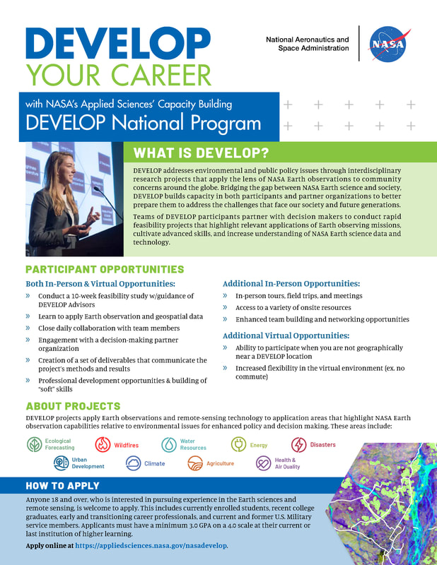  https://skagitpud.applicantpro.com/jobs/2674273.html
PUD #1 of Skagit County is seeking a GIS Asset Analyst. This position reports to the Asset Management Supervisor, and will be responsible for day-to-day support of the GIS system and the Computerized Maintenance Management System (CMMS). This position will coordinate the GIS portion of our Asset Management program, which will include: Support and configuration of ESRI Enterprise GIS software; creating, configuring and administering web-based GIS maps, applications and REST services; design, build and administer Enterprise databases, develop and support QA/QC on new and existing GIS data; perform spatial analysis, geoprocessing, and data conversion tasks; and be primary backup for the Computerized Maintenance Management System (CMMS). In addition, tasks will include administrative support and configuration of Cityworks AMS software; analyzing and interpreting asset data and preparing reports on that data; draft and update system record maps; and participating in the development and upgrading of Skagit PUD GIS standards. Qualifications:
See Job Description for full description, qualifications and requirements Compensation: The hiring hourly pay range will be $38.21 - $42.00 DOE and qualifications. Benefits Package: The District offers a complete benefits package including medical/dental/vision (no cost to employee/dependents), life and disability coverage, PERS pension, deferred compensation options, generous paid time off, holidays, and more. Benefits are equivalent to over 60% in additional compensation. The Seattle Department of Construction and Inspections is seeking two college students to interpret tree data on site plans and enter it in a GIS-based tracking system. Educational opportunities include GIS data entry, research and problem-solving skills, and experience with land use codes and permitting documents.
See the full announcement at https://www.governmentjobs.com/careers/seattle/jobs/3887503/tree-tracking-interns. |
Categories
All
Archives
March 2024
|
 RSS Feed