|
DISTRICT WIDE SERVICES
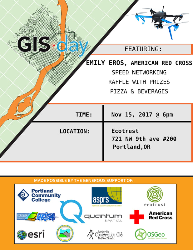
PANTHER PANTRY This program is designed to help students struggling with food gaps. Many students experience hunger as they face the demands of juggling the expenses needed to achieve their educational goals. Emergency bus tickets, Hygiene Packs, and other supplies are available to students. Additionally, Student Leadership has free food at many of our events, visit www.orgsync.com to see what events are happening on your campus. Student Leadership Office Locations: Southeast: Mount Tabor Hall 152 Cascade: Student Union 207 Rock Creek: Building 5 Room 119 Sylvania: CC 221 EMERGENCY GRANTS/LOANS Students can apply for emergency grants. Grants will be considered for students who are experiencing financial barriers to completing their education. You can receive one grant per term, three per academic year, and six total while enrolled at PCC. Grants are authorized by the Student Leadership Office. To find more information and apply for an emergency grant, go to www.pcc.edu/enroll/paying-for-college/emergency-funds EMERGENCY BUS TICKETS Are you stuck on campus without a way to get home? Do not worry, simply visit the Student Leadership Office at your campus and we will provide you with an emergency bus ticket. CHILD CARE GRANTS Do you have kids? Student Leadership offers childcare reimbursement grants to students in good standing, on financial aid, and Pell-eligible. For more information, please click this link https://www.pcc.edu/resources/child-care/ LEGISLATIVE INTERNSHIP We are looking for 12 qualified students to represent the diverse student population at PCC and learn about the legislative process in Salem, regardless of personal or political ideology. Those students will receive a tuition waiver for the 4 credit internship class in Winter term, as well as a $200 travel stipend. For more details visit https://www.pcc.edu/resources/aspcc/internship.html ALTERNATIVE BREAK PROGRAM Supported by the Student Activity Fee, ASPCC provides students with an opportunity to travel in country and participate in service learning and civic engagement trips for a subsidized fee. Applications now open at https://www.pcc.edu/resources/aspcc/alternative-breaks.html CLUBS AT PCC Clubs & organizations offer many opportunities to gain valuable leadership experience, Make connections on campus, Free access to some campus facilities, audiovisual equipment and vending space for fundraising events, Funding for club activities, Access to free marketing materials, Assistance from the Student Life and Leadership Professional staff, and much, much more! Find more information about joining or starting a club on orgsync.com or visit the Student Leadership Office on your campus. Student Leadership Office Locations: Southeast: Mount Tabor Hall 152 Cascade: Student Union 207 Rock Creek: Building 5 Room 119 Sylvania: CC 221 CAMPUS EVENTS AND ACTIVITIES Student leaders are busy all year long planning and organizing events and activities on each PCC campus. These events share culture, promote education and activism, build community, and create an inclusive environment for all PCC students. For more information visit www.orgsync.com or your local Student Leadership office. Student Leadership Office Locations: Southeast: Mount Tabor Hall 152 Cascade: Student Union 207 Rock Creek: Building 5 Room 119 Sylvania: CC 221 PHI THETA KAPPA HONORS SOCIETY PTK is the official community college honors society with over 90 years or recognizing academic excellence. Membership is based on academic achievement. PTK has over 90 million dollars in scholarship opportunities every year. For more information, contact your local chapter on www.orgsync.com or the following locations: Student Leadership Office Locations: Southeast: Mount Tabor Hall 152 Cascade: Student Union 207 Rock Creek: Building 5 Room 119 Sylvania: CC 221 THE GREEN INITIATIVE FUND TGIF Grants provide funding for projects to create a more sustainable campus and reduce the college’s impact on the environment. Any student, faculty, or staff can apply for a TGIF Grant to complete their sustainability project. Visit https://www.pcc.edu/about/sustainability/tgif for more information or to apply. RESOURCE CENTERS Each PCC campus has resource centers which are places for students to find and build community. The Queer, Multicultural, Women’s, and Veteran’s Resource centers are supportive, comfortable, encouraging, and safe environments for all students. PCC Resource Centers strive to create a welcoming environment for all students and serve all populations regardless of gender, gender expression, race, sexuality, country of origin, ethnicity, or documentation status. Portland’s 6th Annual GIS Day Social
Wednesday, November 15, 2017 6:00 PM to 9:00 PM Ecotrust Alder Room, 721 NW 9th Ave #200, Portland, OR (map) Please join us for Portland’s 6th Annual GIS Day Social! This year, we’ll gather in Ecotrust’s beautiful meeting space from 6pm - 9pm. The evening will feature: -- A keynote from Emily Eros of the Red Cross on the Missing Maps program, which aims to put 200 million people "on the map" by 2021 -- Free pizza*, salad and beverages, courtesy of our generous sponsors -- Speed networking to break the ice -- A raffle for some fun geo-prizes! Students, professionals, and anyone interested in GIS and geospatial technologies are all welcome. This is a great opportunity to make some new professional connections and strengthen old ones, and we hope to see you there! This event is volunteer run, and would be impossible without the generous support of our sponsors: Gold level: Quantum Spatial Silver level: ASPRS CRR, PCC, Ecotrust, Red Cross Bronze level: OR-URISA, PDX OSGeo, Esri *Includes some gluten free, veggie, and vegan pizzas (note that this event is also posted to the OR-URISA meetup group: https://www.meetup.com/OR-URISA/events/244216611/) The Scholarship Committee at the American Society for Photogrammetry and Remote Sensing (The Imaging and Geospatial Information Society) wanted to remind you that the scholarship application window is open for the 2018 award year.
Awards will be presented at the ASPRS Annual Meeting, which will be held on Feburary 5-7, 2018 in conjunction with the International LiDAR Mapping Forum (ILMF). Scholarships ranging from $2,000 to $7,000 are available to current students studying imaging, GIS, remote sensing, photogrammetry, surveying, and related digital spatial sciences. Applications are due by October 18, 2017, and letters of recommendation can be submitted by October 21, 2017. Please go to https://www.asprs.org/awards-and-scholarships/student-scholarships-2018-opens-september-1-2017.html to learn more about scholarships that are available. Thank you on behalf of ASPRS Scholarships and Awards. If you have any questions please feel free to email ASPRSScholarships@gmail.com and Scholarships@asprs.org. The Research and Monitoring Technician will aid in the development and implementation of the Palouse Watershed Regional Conservation Partnership Program (RCPP) and Palouse Conservation District (PCD) monitoring program. Reports to the Palouse Conservation District Research and Monitoring Coordinator. Requires excellent communication skills in working with private landowners in a non-regulatory environment. The position requires basic knowledge of environmental data collection and analysis for efficient and effective water quality, soil health, and habitat monitoring programs.
Must be able to hike for extended periods and carry equipment weighting over 40 lbs. through rough terrain, at times in inclement weather conditions. Requirements: B.S. in natural resources or closely related field (preferred) and a valid driver’s license. Full-Time, At-Will, Non-Exempt status; Salary range $31,200 to $40,552 (depending on experience) plus full benefits package. http://www.palousecd.org/ -- Position Description for Research and Monitoring Technician The primary purpose of the Research and Monitoring Technician position is to aid in the development and implementation of the RCPP and PCD monitoring programs. The Research and Monitoring Technician assists the PCD Research and Monitoring Coordinator in designing and implementing a program across the Palouse watershed to monitor changes in water quality, soil health, and habitat associated with changes in conservation measures implemented by private landowners and producers. The installed conservation measures include installing riparian buffers and converting to conservation tillage practices. The Research and Monitoring Technician will be working closely with private landowners and operators and 18 RCPP Partners from local, state, and federal agencies and Land Grant Universities. The Research and Monitoring Technician will be responsible for duties including the following: monitoring water quality, soil health, and habitat; providing technical assistance to landowners and operators who are participating in monitoring efforts; data entry and data analysis including basic statistical analysis; tracking watershed changes throughout time and reporting results; GIS; supervision of interns, volunteers, and/or work crews; and other duties as assigned. Duties and Responsibilities
A Bachelor’s degree in natural resources, environmental science, agriculture, biology, ecology, environmental science, hydrology, geomorphology, riparian management, or a related field. One year of experience monitoring water quality, soil health, and habitat. The applicant must have a demonstrated ability to manage multiple, diverse issues and a proven commitment to land stewardship on private lands. Required knowledge, skills, and abilities:
Compensation: Salary range is $31,200 to $40,552 (depending on experience). Send resume & cover letter to: Research and Monitoring Technician Search Palouse Conservation District, 1615 NE Eastgate Blvd. Section H, Pullman, WA 99163 or ryanb@palousecd.org Review begins October 23rd, 2017. Open until filled. The Oregon Department of Geology and Mineral Industries has launched the Lidar Data Viewer interactive map, which offers additional data and new features that make exploring and downloading lidar easier than ever before.
Visit the viewer: https://gis.dogami.oregon.gov/lidarviewer/ Since the Oregon Lidar Consortium (OLC) was formed in 2007, DOGAMI has collaborated on collection of lidar data with more than 80 partners. The viewer offers OLC data for free download, and now includes data from 18 recent OLC projects. The newly available data includes:
For more information about the Lidar Data Viewer or the Oregon Lidar Consortium, contact: Jake Edwards Oregon Lidar Consortium Coordinator jacob.edwards@oregon.gov 971-673-1557 Fall has come, and so has the rain, but it is the 2nd Wednesday of the month so time to gather at a local establishment. This month let's gather at Lewbrewatory. They'll have a table for us tomorrow @ 5pm (under Tommy) but there happy hour is from 3-6 so if you get there early you can start sampling away.
located at 670 NE Russell Street Labrewatory specializes in craft brews / cutting edge experimentations - check out there website http://labrewatory.com/#home PDX OSGeo Monthly meetingWednesday, October 18, 2017 from 6–8pm
Ecotrust (Jean Vollum Natural Capital Center) 721 NW Ninth Ave Portland, Oregon 97209, US (map) We'll meet in the Ecotrust Alder Room. Enter the atrium of the Ecotrust building from either side. Feel free to bring food and/or beer up with you from Hot Lips or Laughing Planet! Walk up the inside stairs along the East Wall or take the elevator to the second floor. The Alder Room entrance is right behind the Ecotrust front desk. We'll have the gate open for at least the first part of the meeting. If it's not open, call Tanya at 503-475-7833 or just yell through the gate at us :-) Website http://groups.google.com/group/pdx-osgeo Description Monthly meeting of the Portland open source GIS group. Projects big and small are usually presented monthly along with rousing conversation and discussion. All are welcome, no need to RSVP - our group ranges from the geo-curious to the überhackers so bring your ideas and questions! This month's agenda: exciting happenings in geodata, upcoming geoevents. Special guest Emmor Nile will talk about "Using OpenStreetMap in a cross cultural context; experiences of working with OSM Africa". Emmor lived in Ethiopia for 10 months in 2016/17 and volunteered in a variety of OSM projects while there. In addition, bring your own geo-show and tell, and come ready to share info on any fall geo-happenings that are on the horizon! Our mailing list is here drop us a line with any questions: http://groups.google.com/group/pdx-osgeo Would you like to get paid to do what you love and live in paradise? The Catalina Island Conservancy is looking to hire a full-time GIS person to manage the organization's GIS system. As the next GIS Program Manager you would get to do it all - web and desktop applications, data management and analyses as well as field collection. This is a fantastic opportunity for the right individual.
Job description can be found here: http://catalinagis.org/files/GIS_Program_Manager_17Sep26.pdf Please visit our website www.catalinaconservancy.org and click the link Job Listings for more info. The position has only recently become available so may not be listed on the website yet, but do not let that deter you! Send your resume and cover letter to jobs@catalinaconservancy.org The American Society for Photogrammetry and Remote Sensing
Columbia River Region Chapter welcomes you to their quarterly social event. WHERE: Lucky Lab Brewery 915 SE Hawthorne Blvd, Portland, OR 97214 WHEN : Thursday, October 12, 2017 - 5:30 pm – 7:30 pm Come join us if you are you interested in… • LiDAR • GIS • UAV • Photogrammetry • Aerial Imagery We welcome all active and inactive members, those who are curious about the society or anyone who simply wants to nerd out on geospatial stuff! Meet friends, professionals, network and enjoy some Lucky Lab beverages on us. |
Categories
All
Archives
March 2024
|
 RSS Feed