CHRISTINA FRIEDLE

Geospatial Jobs, Internships, events, news & More

  • Home
  • About Me
  • Courses
  • GIS Club
    • About Us
    • Don't be a Dangle!
    • Event Calendar
  • Resources
    • Data
    • Tools
    • Blogs
    • ArcGIS Install
  • Blog
  • Aventuras Colombianas

10/30/2019

PDX GIS Day 2019 - Nov 13!

0 Comments

Read Now
 
Picture

Share

0 Comments

10/30/2019

GIS Club event: Pizza, Professionals, Powerpoint

0 Comments

Read Now
 
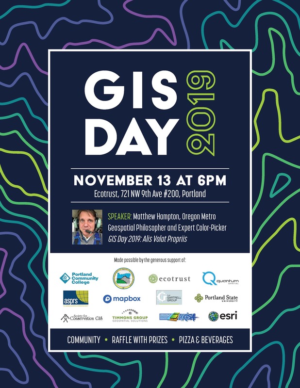
Where: Cramer Hall, Room 418

When: Monday, Nov. 4th from 4pm - 6pm

Welcome to our very first PSU and PCC GIS club event of the term! We are inviting everyone that is interested in GIS to come network, eat pizza and listen to student speakers talk about their summer internships. It will be a great time to get to know fellow students in GIS classes and those in both the PSU and PCC GIS club. Future events for the club will also be addressed in this event, so don't miss out!
Picture

Share

0 Comments

10/29/2019

PCC is hiring a Full-time GIS Instructor (pdx)!

0 Comments

Read Now
 
 The application best consideration date is Dec 1, 2019. The position will start in Fall 2020. 

Position Summary: The Geography Department, at Portland Community College's Sylvania Campus, seeks a full-time Instructor with diverse experience using geospatial technologies and an innovative teaching style to begin Fall 2020. The Geography department currently offers a GIS Certificate and is developing a UAS Certificate and an Associates of Applied Science in Geomatics.

For full application details:
https://pcc.csod.com/ats/careersite/JobDetails.aspx?id=493&site=9  

Share

0 Comments

10/27/2019

GIS Specialist w/ Dept of Interior (Lakeview, OR)

0 Comments

Read Now
 
https://www.usajobs.gov/GetJob/ViewDetails/549047500
​

Physical Demands/Work Environment:
 
The work is primarily in an office setting, sedentary, requires long periods of sitting in one position, and intense concentration for several hours at a time. Stress may be experienced on a regular basis in attempting to respond to conflicting objectives and tight deadlines with limited resources. Occasional fieldwork may be required in support of resource mapping projects, involving extended days of travel in remote settings and in poor weather conditions.

Responsibilities

The incumbent provides support and advice for application of geospatial technology under the guidance and direction of a higher level specialist and/or supervisor. They are responsible for a wide range of spatial information required to support the management of public lands. The incumbent must have an effective mix of technical skills in the geographic and computer science disciplines, including ARCGIS, and GPS. Duties include input into a variety of databases. Providing technical user support for all aspects of geospatial data and software. Work with a diverse group of resource specialists, planners and managers to coordinate and implement GIS activities, to include; development of project objectives, evaluation of adequacy of existing data sources, creation/modification of GIS coverage, databases, analysis, and preparation of final output products.

Share

0 Comments

10/27/2019

GIS Specialist w/ King County (Seattle, WA)

0 Comments

Read Now
 
https://www.governmentjobs.com/careers/kingcounty/jobs/2604084/gis-specialist-journey
​

JOB SUMMARY:
 
The Department of Natural Resources and Parks is seeking an energetic and motivated GIS Specialist to support programs and projects within the Wastewater Treatment Division (WTD). This position will perform a wide range of GIS data development and maintenance, mapping, and analytical tasks as well as development of scripting solutions and maintenance of ArcGIS Online web mapping products. This position may work independently developing and executing moderately complex analyses and developing solutions for complex questions. They may coordinate with other County professionals and outside agencies to ensure successful delivery of GIS data, products and services. They may serve as leader of interdisciplinary work teams managing content, configuration and support of GIS online maps and tools.

WORK LOCATION:
 
King Street Center, 201 S. Jackson Street, Seattle, Washington, with travel required to other WTD locations throughout King and South Snohomish County.

WORK SCHEDULE:
 
This Special Duty Assignment or Term Limited Temporary position is Fair Labor Standard Act (FLSA) non-exempt and is overtime eligible. The regular workweek is full-time 40 hours, Monday through Friday.
WTD is committed to the principles of equity and social justice. We value diverse perspectives and life experiences in our workforce, and are committed to building a culturally diverse and inclusive environment. WTD strives to provide equitable services to residents and businesses across King County.

Job Duties

The successful candidate will:
  • Coordinate data acquisition and use with County professionals and outside agencies.
  • Coordinate with Flow Monitoring staff to maintain GIS based flow monitoring tools and datasets.
  • Coordinate with Conveyance Inspection staff to maintain functional and technical integration between GIS and CCTV inspection program and provide guidance and support to current CCTV software upgrade effort. Create and maintain spatial and tabular GIS data and appropriate metadata for use by Wastewater Modeling Staff.
  • Conduct GIS analyses in support of WTD planning, capital, and operational efforts.
  • Design, produce, and deliver maps, tables, and other graphic products to report on research and analytical findings
  • Maintain WTD enterprise local sewer dataset.
  • Support the development of and deployment of products and services for clients using the online capabilities of ArcGIS, particularly ArcGIS Online, ArcGIS Solutions, and Web Apps to display current wastewater related information.
  • Organize content to support the development of the WTD-GIS webpage
  • Develop and maintain effective working relationships with project clients, stakeholders and team members.
  • Consult with project clients and stakeholders to achieve satisfactory results of requested products by identifying any necessary qualitative and/or procedural refinements.
  • Work independently at a high level of productivity while organizing, scheduling, and managing workloads and individual assignments.

The successful candidate will embody the following competencies:
  • Problem Solving - Uses rigorous logic and methods to solve difficult problems with effective solutions; probes all fruitful sources for answers; can see hidden problems; is excellent at honest analysis; looks beyond the obvious and doesn't stop at the first answers.
  • Planning – Accurately scopes out length and difficulty of tasks and projects; sets objectives and goals; breaks down work into the process steps; develops schedules and task/people assignments; anticipates and adjusts for problems and roadblocks; measures performance against goals; evaluates results.
  • Functional/Technical Skills – Has the functional and technical knowledge and skills to do the job at a high level of accomplishment.
  • Time Management– Uses his/her time effectively and efficiently; values time; concentrated his/her efforts on the more important priorities; gets more done in less time than other; can attend to a broader range of activities.

The ideal candidate should have:
  • Knowledge of GIS production of complex cartographic and other spatial data displays, analysis, and applications.
  • Two years of applied professional experience in the application and use of GIS technology including two years of applied professional experience with ArcGIS 10.3 or higher
  • Applied professional experience, knowledge and skills with latest versions of ArcGIS Online, ArcGIS Pro, Python, and ArcGIS Solutions.
  • Excellent oral and written communication skills
  • Experience and proficiency with MS Office Suite products, including word processing, spreadsheet, database, scheduling and e-mail. Perform accurate data entry in a timely manner. Must be comfortable with internet and intranet usage and management of electronic documents.
  • Skills in conducting research on specific work assignments, use of analytical, problem-solving, and troubleshooting skills, and maintaining confidentiality on sensitive matters.
  • Skill in analyzing moderately complex customer business needs
  • Skill in working with a variety of individuals from diverse backgrounds
  • Skill in handling multiple competing priorities, effectively handling a number of detailed projects or tasks simultaneously.
  • Demonstrated initiative and accountability for delivery of detail oriented products or services as directed.
  • Skill in working in a team environment; Ability to establish and maintain effective working relationships with other staff.
  • Ability to learn quickly and movie forward with work assignments efficiently and productively, guiding and assisting others when needed.
  • Ability to deal with ambiguity and ability to problem solve with uncertainty
  • Develop and communicate workflow processes and providing solutions as needed.
  • Bachelor's Degree in Geography, or in a science or technology field with significant application in GIS, or an equivalent combination of GIS experience and knowledge

HIGHLY DESIRABLE:
  • Knowledge of wastewater treatment facilities and processes.
  • Knowledge of basic project management concepts
  • Understand engineering drawings.

LICENSE / CERTIFICATION:

A Valid Washington State Driver's License

Share

0 Comments

10/27/2019

GIS Analyst w/ FLO Analytics (pdx)

0 Comments

Read Now
 
https://maulfoster.applicantpool.com/jobs/385997-17241.html?er=0c36019d327deec488f3ca03b720b8d6

Description: 
FLO Analytics (FLO) is looking for a talented GIS Technician/Analyst for our Portland office. As GIS Technician/Analyst, you will support GIS project work alongside a collaborative team of GIS and data analytics professionals. You will provide a broad range of GIS technical support on projects with duties typically including data compilation, standardization, and management; geographic data mapping; spatial analysis; web mapping application development and maintenance; cartographic product creation; and project reporting assistance.

FLO specializes in Geographic Information Systems (GIS) and data analytics services, serving school districts, government, utilities, non-profit groups, and various businesses and industries in the Pacific Northwest and beyond. FLO supports and is a key innovator within Maul Foster & Alongi, Inc. (MFA), a locally owned Pacific Northwest consulting firm specializing in the areas of environmental science, engineering, planning, and GIS. Since 1996, MFA has grown to over 120 employees, with offices in Oregon, Washington, Idaho, and Massachusetts.

Minimum Requirements
  • BA/BS degree from an accredited college or university in geography, environmental studies/science, planning, or a related field with an emphasis in GIS
  • 12 credit hours in GIS-specific courses
  • 2+ years of GIS work experience
  • Competence with Esri's ArcGIS Desktop suite (ArcMap, ArcCatalog, ArcToolbox)
  • Familiarity working within Esri's ArcGIS Online
  • Experience working within the geodatabase environment, including creating, editing, and management
  • Proven ability to perform GIS data conversion/editing, spatial analysis/reporting tasks, database management, and GIS map production
  • Proficiency in Microsoft Outlook, Word, Excel, and Access
  • Proven organizational and problem-solving skills and attention to detail
  • Able to formulate and communicate ideas, both verbally and in writing
  • Ability to work effectively with minimal supervision and in a collaborative group environment
  • Willingness to work overtime and travel as needed

Desired Skills and Abilities
  • 3+ years' of GIS work experience
  • Previous professional consulting experience
  • Experience working with ArcGIS Desktop extensions (e.g., spatial analyst, network analyst)
  • Familiarity working within Esri's Pro environment
  • Experience in advanced geospatial analysis and modeling principles using a variety of ArcGIS environments (e.g., ModelBuilder, Python scripting)
  • Experience working with a broad range of demographic datasets
  • Completion of a statistics and/or spatial statistics college course
  • Experience with data blending, visualization, or analysis software (Tableau, Alteryx)

​Salary & Benefits:
  • Compensation based on individual qualifications and experience
  • Medical, dental, and vision insurance
  • 401(k) Plan
  • Participation in employee stock ownership plan (ESOP)
  • Paid time off
  • Training and development opportunities

Share

0 Comments

10/27/2019

GIS Architect w/ Washington Technology Solutions Department

0 Comments

Read Now
 
GIS Job Opportunity with WATech

​The Washington Technology Solutions (WATech) Department is recruiting to fill one part-time (32 hours) permanent Geographic Information Systems (GIS) Architect within the Office of the Chief Information Office (OCIO), Geospatial Program Office.  This position serves as the Geospatial Architect and Systems Administrator and reports to the State GIS Coordinator.  In this role, you will work with dedicated GIS/ IT professionals who support delivery of services to other state agencies, local government and the public.  This position is expected to be innovative, creative and a team player.  
​

Visit Governmentjobs.com  to view the full advertisement and application.

Share

0 Comments

10/24/2019

GIS job w/ Jarrett Walker & Associates (pdx)

0 Comments

Read Now
 
https://jarrettwalker.com/jwa-is-hiring-in-portland/

About JWA
Jarrett Walker + Associates is a consulting firm that helps communities think about public transit planning, especially the design and redesign of bus networks. You can learn about us at our website (jarrettwalker.com) and at Jarrett’s blog (HumanTransit.org).

What does a typical day look like?
At JWA, analysts work on many different aspects of transit planning projects, using different tools and skillsets. For example, early on in a project, you could be asked to draw a map showing the frequency of each route in a transit network using Adobe Illustrator and QGIS. On another day, you might be asked to lay out a report in Adobe InDesign or create a set of charts in Excel or using R’s ggplot plotting package. Once you’re more experienced, you might make site visits to our clients in other cities to help with a design workshop or a public meeting. We also work together using R and other data analysis programming languages to conduct detailed analyses of existing transit service performance and compare different planning options.

Because our team is small and our projects are highly varied, we seek to hire and provide training to ensure the widest range of ability possible among our staff.

Required Skills and Experience
For this position, the following are requirements.
  • Two or more years professional experience using the skills listed in this section, or formal training in these skills (such as at a college or university). Directly applicable coursework is valuable but not essential.
  • Fluency in written and spoken English. In particular, an ability to explain analytic ideas clearly.
  • Understanding and experience with analysis and visualization of quantitative or spatial information, including working with GIS.
  • Experience in cartography, evidenced in at least one mapping sample that is clear, accurate, and visually appealing.
  • Availability to start work in early January 2020, at least 32 hours per week.
  • Willingness to travel occasionally (2-6 times per year) for projects.
  • Legal ability to work in the US as of early January 2020.

Evaluation of candidates

When we evaluate candidates, we will look for a combination of analysis skills and instincts; cartography skills; transit planning interest or experience; and interpersonal/teamwork skills.

Compensation, Benefits and Place of Work
Compensation will start in the range of $25-33/hour. Large raises in the first year are common. Our benefits program includes medical, dental, and disability insurance; a 401(k) program; subsidized and pre-tax transit benefits; paid sick leave; and paid time off.

This position will require working out of either our Portland, Oregon (Inner Southeast). JWA allows employees to set work schedules that include working from home or other locations for some of their work time, but employees will be expected to work in their primary office for most of their work hours. This position will likely require occasional travel, to work with clients directly, a few times per year, and, potentially, travel for training or conference.

Growth and Development
The position offers the potential to develop a range of transit planning skills. Everyone pitches in at many different levels, and there are opportunities to learn more advanced skills either on the job or through attendance of professional conferences or other structured training.

How to Apply
To apply, please send the following materials to hiring@jarrettwalker.com
  • 1-page cover letter explaining your interest in the position.
  • 1 or 2-page resume describing your relevant experience and skills – technical, planning, and interpersonal. Please include experience working on projects or in teams with people from different backgrounds.
  • Links or electronic files for up to three (3) samples of your work. If possible, please include a map, a piece of writing, and a demonstration of a spatial analysis. (A single sample may satisfy more than one of these requests.)
    • If you submit a university group project or other collaborative document with multiple authors that is not solely your work (i.e. government agency, nonprofit or consulting reports), please include a short note clarifying your role in the production of the document. For example, if you provide as a work sample a group project from a university course for which you designed all of the maps but were not the primary author of the text, please include a note saying so.
  • Contact information for 1 to 3 references who can attest to your experience with the skills listed above. Please do not include any information about your prior compensation.

Diversity and inclusion
JWA follows an equal opportunity employment policy and employs personnel without regard to race, color, religion, sex (including pregnancy, gender identity, and sexual orientation), national origin, age, disability, or genetic information.

This policy also applies to management of staff with regards to internal promotions, training, opportunities for advancement, and terminations. It also applies to our interactions with outside vendors, subcontractors, and the general public.

Share

0 Comments

10/24/2019

Wisdom Workforce Recruiting PAID Interns- Fall 2019

0 Comments

Read Now
 
INTERNSHIP STARTS FALL/WINTER 2019
CONTACT ALVEY SEEYOUMA ALVEY@WISDOMOFTHEELDERS.ORG or call 503-775-4041 to schedule a time to meet or for assistance with an application. Our office is located at 3203 SE 109th Ave, Portland, OR.

Wisdom Work Force Development interns will receive a monthly stipend for training in:

-Environmental Assessment and habitat restoration using Wisdom's culturally tailored multimedium curriculum. Native plant species including first foods, climate change, invasive species, and field safety.

-Complete service learning in natural areas

-After your internship, be eligible for hire by Wisdom Workforce Development, LLC, where you will receive a living wage as a member of our Native American Workforce team completing environmental restoration work

-Referrals to paid internships and other job opportunities with local environmental organizations and other community partners.

Wisdom Work Force Development is a program of the Native American 501 (c)(3) non profit, Wisdom of the Elders, Inc., Wisdom, located in Portland, Oregon. Since 1993, Wisdom has recorded, preserved, and shared oral history, cultural arts, and traditional ecological knowledge of exemplary Native elders and scientists in collaboration with diverse organizations, educational institutions, and government agencies.

Share

0 Comments

10/23/2019

Information Tech GIS Supervisor/Coordinator w/ City of Tacoma (WA)

0 Comments

Read Now
 
Position Title: Information Technology GIS Supervisor/Coordinator
Annual Salary: $104,104.00 - $133,452.81
Location: Tacoma, WA
Agency: City of Tacoma, Information Technology Division
Job Number: 0136-19B
Application submission deadline: 10/28/2019 5:00 PM Pacific
 
The Opportunity:
The City of Tacoma's Information Technology Department is seeking an energetic, highly motivated, and skilled GIS Supervisor/Coordinator to oversee and direct GIS database/applications development, analysis, production of standards and procedures, maintenance, supervision of personnel, and implementation; provide advice and recommendations to management and users and provide Geographic information systems services and technical advice as needed.
 
For more information or to apply, please visit:
https://www.governmentjobs.com/careers/tacoma/jobs/2589068/information-technology-gis-supervisor-coordinator?keywords=GIS&pagetype=jobOpportunitiesJobs

Share

0 Comments
<<Previous
Details

    Archives

    December 2021
    November 2021
    October 2021
    September 2021
    August 2021
    July 2021
    June 2021
    May 2021
    April 2021
    March 2021
    February 2021
    January 2021
    December 2020
    November 2020
    October 2020
    September 2020
    August 2020
    July 2020
    June 2020
    May 2020
    April 2020
    March 2020
    February 2020
    January 2020
    December 2019
    November 2019
    October 2019
    September 2019
    August 2019
    July 2019
    June 2019
    May 2019
    April 2019
    March 2019
    February 2019
    January 2019
    December 2018
    November 2018
    October 2018
    September 2018
    August 2018
    July 2018
    June 2018
    May 2018
    April 2018
    March 2018
    February 2018
    January 2018
    December 2017
    November 2017
    October 2017
    September 2017
    August 2017
    July 2017
    June 2017
    May 2017
    April 2017
    March 2017
    February 2017
    January 2017
    December 2016
    November 2016
    October 2016
    September 2016
    August 2016
    July 2016
    June 2016
    May 2016
    April 2016
    March 2016
    February 2016
    January 2016
    December 2015
    November 2015
    October 2015
    September 2015
    August 2015
    July 2015
    June 2015
    May 2015
    April 2015
    March 2015
    February 2015
    January 2015
    December 2014
    November 2014
    October 2014
    September 2014
    August 2014
    July 2014
    June 2014
    May 2014
    April 2014
    March 2014
    February 2014
    January 2014
    December 2013
    November 2013
    October 2013
    September 2013
    August 2013
    July 2013
    June 2013
    May 2013
    April 2013
    March 2013
    February 2013
    January 2013
    December 2012
    November 2012
    October 2012
    September 2012
    August 2012
    July 2012
    June 2012
    May 2012
    April 2012
    March 2012
    February 2012
    January 2012
    December 2011
    November 2011
    October 2011
    September 2011
    August 2011
    July 2011
    June 2011
    May 2011
    April 2011
    March 2011
    February 2011
    January 2011
    December 2010
    November 2010
    October 2010
    September 2010
    August 2010
    July 2010
    June 2010
    May 2010
    April 2010
    March 2010
    February 2010
    January 2010
    December 2009
    November 2009
    October 2009
    September 2009
    May 2009
    April 2009

    Categories

    All
    Aag
    Americorps
    Animations
    Applied GIS
    Applied Gis
    Apps
    Article
    Articles
    Asprs
    Books
    Careers
    Cartography
    Competition
    Conferences
    Conservation
    Diaster Mapping
    Drones
    Environmental
    Esri
    Events
    Fellowships
    Games
    Geoapp
    Geographic Awareness
    Geography
    Geomatics
    Geospatial Technologies
    GIS
    GIS Data
    Gis Data
    GIS Day
    GIS Day
    GIS Resources
    Gis-resources
    Google
    Google Earth
    Google Maps
    Gps
    Graduate School
    Grants
    Happy Hour
    Happy Hours
    Humor
    Hydrology
    International
    Internships
    Interviews
    Job
    Jobs
    Journals
    Lecture
    Lidar
    Maps
    Meeting
    National Geographic
    Natural Resources
    Open Source
    Oregon
    PCC
    Podcast
    Porland
    Portland
    Presentations
    Professional Development
    Professional-development
    Projections
    Raster
    Remote Sensing
    Research
    Scgis
    Scholarships
    Social Networks
    Software
    Songs
    Story Maps
    Study Abroad
    Technical Help
    Tools
    Training
    UAS
    UAV
    University
    Urban Design
    Videos
    Visualization
    Webinar
    Web Mappping
    Websites
    Women In GIS
    Workshops

    RSS Feed

Contact ME

  • Home
  • About Me
  • Courses
  • GIS Club
    • About Us
    • Don't be a Dangle!
    • Event Calendar
  • Resources
    • Data
    • Tools
    • Blogs
    • ArcGIS Install
  • Blog
  • Aventuras Colombianas