 Portland Community College is offering (non-credit) a course in Cartography for Wilderness Exploration.
There will be six class meetings, three lectures and three labs: (all class meetings are on Saturday at Sylvania in HT301 from 1:00 PM - 2:50 PM) If the class is successful we will ...
Students will use existing maps and/or verbal descriptions to pick a place that looks interesting but is not widely known. We'll gather publicly available information and make our own maps using free (or low cost) GIS programs. I hope that we all have a chance to hike and/or scramble to the places we picked and see how closely our maps matched the real world. For some students this may be an introduction to Geographic Information Systems (GIS) that may lead to enrollment in a PCC Geography Degree Program and a career in GIS. 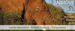 Combining remote sensing and statistical spatial modelling for conservation and biodiversity research is resulting in an increased understanding of species-environment relationships. In order to increase the knowledge how to apply and combine these methods for conservation and biodiversity policy a Summer School on Animal Movement & Remote Sensing for Conservation and Biodiversity research will take place in August 2013. The dead-line for applications to the AniMove 2013 summer school on analysing animal movement and remote sensing data for conservation is approaching. Applications need to be submitted by the end of March. This Summer School provides participants with profound knowledge of remote sensing and species distribution and animal movement for conservation. It includes courses on the theoretical background as well as hand-on exercises ranging from animal tracking, land cover and species distribution analysis to analysing and modeling of animal movement in conjunction with ecologically relevant remote sensing data sets. The results will be discussed and interpreted within the aims of CMS and others. more information can be found at: http://remote-sensing-biodiversity.org/animove2013 (and soon on http://www.animove.org)  Franklin County is looking for a GIS Manager, please see attached Job Description and visit http://www.co.franklin.wa.us/humanresources/joblisting41.php for additional details.
 Tualatin Valley Water District believes that each employee makes a significant contribution to our success. That contribution should not be limited by the assigned responsibilities. Therefore, this job description is designed to outline primary duties, qualifications and job scope, but not limit the incumbent nor the organization to just the work identified. It is our expectation that each employee will offer his/her services wherever and whenever necessary to ensure the success of our endeavors.
Temporary Position: Limited duration from June thru September, approximately 40 hours per week. Temporary employees are not eligible for benefits except those required by law. Overall Purpose of the Job: The overall purpose of the position is to perform basic Geographic Information Systems (GIS) mapping functions in support of the Engineering Department. Such functions may include: - Assist with input and editing of GIS data. - Assist with spatial analysis. - Assist with map preparation. - Assist with Global Positioning System (GPS) data collection and input in to GIS. - Assist other GIS users (field and office staff) within the organization. - Other projects and duties as required. Knowledge Required: - Basic understanding of ESRI GIS software with some practical experience is required. - Basic understanding of ESRI topology rules and topology editing is desirable. - Basic understanding of GPS with some practical experience is desirable. - Basic understanding of Computer Aided Design (CAD) is desirable. - Good mathematical skills. - Proficiency in Microsoft Office, Word and Excel – both data entry and reporting format skills. - Ability to communicate clearly with TVWD staff and other entities both verbally and in writing. Minimum Requirements: - Currently enrolled in a degree program related to GIS. - Valid Oregon State Driver’s License; have and maintain a safe driving record. Working Conditions: - Have regular and predictable attendance. - Prolonged periods of sitting or standing. - Daily focus and reading of information on a computer screen. - Work may include field time in inclement weather. - Ability to perform physical tasks that are moderately demanding. Closing Date: April 8, 2013 at 4:30 p.m. Rate of Pay: $15.50 per hour Job Description: Microsoft Word | PDF Application (be sure to fill out supplemental questions at the end of the application): Microsoft Word | PDF Send completed applications to: You can E-mail your application to our Human Resources Department Fax: (503) 356-3190 Mail: TVWD, Attn: Human Resources, 1850 SW 170th Ave, Beaverton, OR 97006 You can also drop off an application at TVWD Headquarters.  The City of Wilsonville GIS department is seeking 2 interns for a special project internship, working closely with the City’s Engineering Department. The goal is to update the GIS system with any features and attributes that may exist in the CAD database but not in the GIS based as-built database. The project is expected to last three months.
Please see the “GIS Intern” job announcement as well as instructions for filing an application at: http://www.ci.wilsonville.or.us/Index.aspx?page=438 Please direct all questions to HR Manager Andrea Villagrana: villagrana@ci.wilsonville.or.us  The 2013 Oregon Urban and Community Forestry Conference is on Thursday, June 6 at the World Forestry Center.
Urban Forestry Strategies: Linking People and Landscapes Dr. Kathy Wolf of University of Washington will keynote. Full conference agenda online and and early bird registration open: http://oucfc2013-eorgf.eventbrite.com/#  Invasive Species Internships Available with Clark Public Utilities
Project Location: 8600 NE 117th Avenue, Vancouver, Washington 98668 Start date: Position available starting in June. Full-time start date flexible. The watershed enhancement program at Clark Public Utilities began in 1992 and has grown to become a regionally recognized environmental restoration effort. Since the program’s inception, volunteers from a variety of backgrounds have planted over 700,000 native trees to bring salmon back to Salmon Creek. Unfortunately a variety of non-native invasive plant species threaten these important riparian ecosystems. Invasive Species Outreach and Education Internship The Outreach Intern will support the Utilities’ Eradication Nation program, which is focused on removing non-native invasive plants from riparian areas in the Salmon Creek Watershed. This program promotes stewardship by engaging community members to play a part in the invasive species control process through coordinated outreach and organized volunteer events. The Outreach Intern will assist with field activities such as knotweed surveys and control, but will primarily focus on conducting outreach to the community. To be eligible for the internship, applicants must be enrolled in at least ten credits per term during the school year. See attachment for detailed responsibilities and requirements. Invasive Species Internship The Invasive Species Intern will support the Utilities’ Eradication Nation program. This program is focused on controlling invasive Japanese knotweed and other invasive plant species in the Salmon Creek watershed. This internship will provide the opportunity to develop a number of natural resource management skills that focus on invasive species control. To be eligible for the internship, applicants must be enrolled in at least ten credits per term during the school year. See attachment for detailed responsibilities and requirements. Work hours / internship duration: Interns are expected to work a minimum of 40 hours per week during the summer. Flex time will be given for weeks where interns are expected to work on Saturdays. Internship duration is from early June to late September, approximately 500 hours. Compensation: Interns must maintain a minimum of ten credit hours per term or semester to be eligible for compensation. School attendance is not required during the summer break. $9.50 per hour to start; $10.50 after 520 hours. This is a non-benefited position. Submit cover letter, resume and references by April 15, 2013 to: Bethany Lund, Invasive Species Program Coordinator, blund@clarkpud.com, 360 992 8787 Visit our website – www.streamteam.net, click on Eradication Nation for more information about the program.  HawkWatch International
Pacific Northwest Regional Coordinator / Research Biologist The Pacific Northwest Regional Coordinator / Research Biologist (RC) is the all-around representative of HawkWatch International (HWI) in the Pacific Northwest (PNW) Region. Reporting to the Executive Director, the RC will work closely with staff from all HWI departments, including Conservation, Education, Science, and Development/PR to carry out HWI’s activities in the region. This position is based in Portland, OR and reports to the Executive Director. Primary responsibilities fall into three categories: 1) Coordinating and operating the fall migration monitoring site(s) in the region, specifically Bonney Butte, OR and Chelan Ridge, WA; 2) Working closely with Conservation Department staff to secure new scientific research and contractual projects in the region, as well as organizing and conducting the projects; and 3) Educating various audiences such as managers, other scientists, and the general public through presentations, programs, field trips, and expanding HWI’s volunteer program in the PNW region. All of these responsibilities require extensive networking and relationship building with government agencies, industry contacts, other nonprofits, scientists, volunteers, and donors. Specific Responsibilities Fall Migration Monitoring Working closely with the Science Department:
Conservation and Professional Services Projects Working closely with the Conservation Department:
Education and Outreach Working closely with the Education and Development Departments:
Other
Education and Skills Required
Preferred
Terms and Compensation
Application Procedure Submit by email to Caroline Goldman, Executive Director, cgoldman@hawkwatch.org
Application screening will begin immediately and the position is open until filled. Please try to submit applications by March 31, 2013 for greatest consideration.  Summary:
West Multnomah Soil & Water Conservation District is hiring a part-time Field Intern for the summer of 2013 (approximately June –September). This internship is designed to provide experience in the areas of water quality, invasive species, habitat restoration, forestry and agricultural land uses. Work will be split evenly between field work and office work. Field work will include data collection, inventories, and planning involving the “areas” listed above. Office work will involve mapping with ArcGIS with some technical writing and office communication. Candidates should have a strong knowledge of plant identification. A good understanding of GIS is also required and applicants should be able to create shape files and produce maps. The person filling the position should also possess knowledge/experience in the following areas: - Field work & basic surveying - Public speaking - Report & article writing - Project management - Data entry and management - Ability to use personal vehicle and clean driving record http://www.wmswcd.org/public/file/Employment%20Opportunities/2013_Summer_Field_Intern.pdf |
Categories
All
Archives
March 2024
|
 RSS Feed