|
Calling All Community College Student Innovators & Faculty/Administrator Mentors!
The deadline for the 2024 Community College Innovation Challenge (CCIC) is fast approaching! The CCIC is hosted by the American Association of Community Colleges in partnership with the National Science Foundation. It is a national competition where teams of community college students work with a faculty or administrator mentor to use science, technology, engineering, and mathematics (STEM) to innovate solutions to real-world problems, receive full travel support to attend an Innovation Boot Camp in Washington, D.C., and compete for cash awards. The Innovation Boot Camp provides professional development, mentoring, and coaching sessions to build strategic communication and entrepreneurial skills to help students advance their innovations in both the public and private sectors. The Boot Camp culminates in a poster session and engagement opportunity with STEM leaders and Congressional stakeholders, and a pitch presentation in front of a panel of industry professionals to determine the first, second, and third-place winning teams. Diverse and interdisciplinary teams that include students in STEM, business, humanities, and other fields are encouraged to apply. To hear from past participants and judges about the positive impact of participating, view our CCIC Information Sessions here. DEADLINE: Submissions are due by April 2, 2024. What can you do? JOIN: Assemble a student team and become a faculty or administrator mentor. SHARE: Help us spread the word and join the conversation online! #CCIChallenge2024. APPLY: Encourage students to learn more or apply at www.aaccinnovationchallenge.com. For questions, email CCIC@aacc.nche.edu. Please join us this Thursday OCT 28 for the fourth installment of our Fall 2021 speaker series! This week's Zoom talk is hosted again by Hunter Shobe and David Banis from PSU's very own Geography Department, this time featuring contributors Geoff Gibson, Sachi Arakawa, and Alicia Milligan. The topic is "Making a Cultural Atlas of San Francisco, Portland, and Seattle." Please see the attached pdf flier for more information and the clickable zoom link, as well as the attached schedule for coming speakers this term! 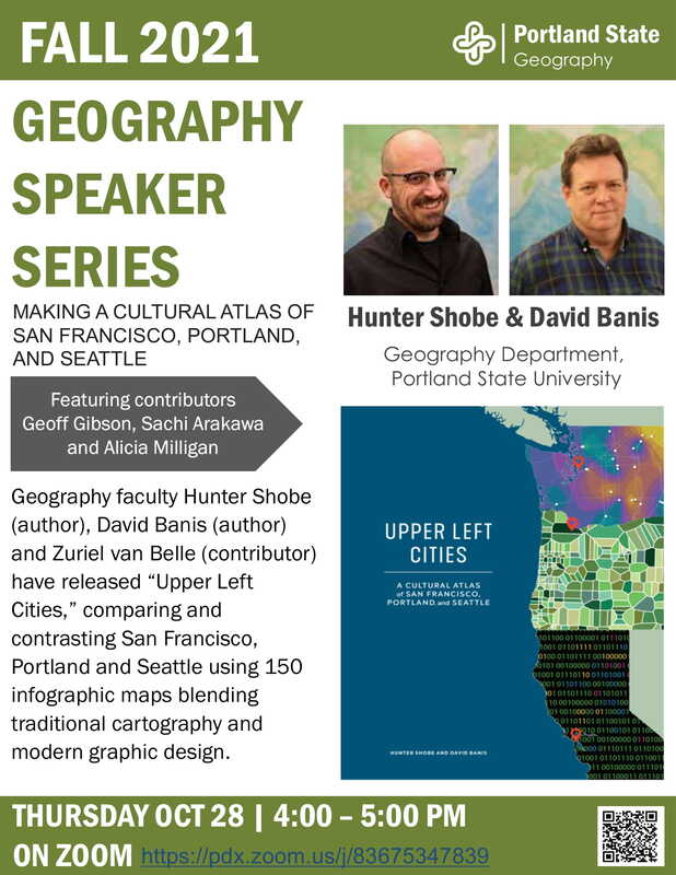 Spatial analysis of post-fire vulnerability and resilience in wildland urban interface communities
Position Title Research Associate (Post-Doctoral) Department of Fisheries & Wildlife, Oregon State University, Corvallis, OR 97331 Position Description The successful applicant will be appointed to work under the supervision of Dr. Lisa Ellsworth (College of Agricultural Sciences, Department of Fisheries and Wildlife) and Dr. Jenna Tilt (College of Earth, Ocean, and Atmospheric Sciences), together with a collaborative research team including engineering professors and students from Oregon State University (Dr. Erica Fischer), University of Colorado, Boulder (Dr. Brad Wham), and University of Minnesota (Dr. Lauren Linderman). Work Locations Oregon State University, Corvallis, OR with the potential for remote work during COVID limitations Position Summary The Department of Fisheries and Wildlife, Oregon State University invites applications for a full-time (1.0 FTE), 12-month, fixed-term Postdoctoral Research Associate position. Reappointment for an additional 6-12 months is possible depending upon annual review and availability of funding. The 2017 Tubbs Fire and the 2018 Camp Fire caused significant damage to civil infrastructure in Santa Rosa and Paradise, California, respectively. An unanticipated, but significant impact following these fires was contamination of the public drinking water. The contamination imposed an enormous burden on the municipal water districts in Santa Rosa and Paradise to determine the location of the contamination source(s), and the investigation has cost millions of dollars. The Research Associate will develop geospatial models that consider topography, fuel, vegetation and soil types, pipe vulnerability, human demographics, and community recovery to predict pre-fire risk and post-fire recovery related to water infrastructure. We anticipate models will include various data types including: high-resolution remote sensing, locations of in situ pipeline networks, geolocation and frequency of social media postings (i.e. Twitter, Facebook) regarding water contamination, fuel loads, soil types, human demographics, topography, etc. The analysis will be used to inform a prototype web-based tool to be used by city planners and emergency responders. Strong spatial analysis skills are necessary. An ability to work independently and constructively as part of a broad, interdisciplinary research team is critical. Position Duties The successful applicant will be appointed to carry out duties as follows: 70% Conduct research and spatial analyses on pipe vulnerability, topography, fuel, vegetation and soil types, demographics, and community recovery to predict pre-fire risk and post-fire recovery of water infrastructure, and present results in written and oral scientific and outreach communications. Publication in scientific journals is expected. Participation in grant-writing with PIs to fund the next stage and future expansion of project topics. 30% Communication with scientists, city and county municipalities, professional and stakeholder groups, computer programmers, and members fire-impacted communities in informal and formal workshop settings. Create outreach materials for general audiences. Work conditions: The Research Associate will primarily work in an office setting. Some travel to visit fire-impacted areas and participate in stakeholder workshops is expected. Minimum/Required Qualifications: · Candidate must have earned a PhD or equivalent degree in fire science, landscape ecology, geography, urban planning, or a closely related field by the start date of appointment · Demonstrated research accomplishments and publications in the primary research literature. · Demonstrated knowledge of utilizing geospatial software and related products (i.e. Google Earth Engine, ENVI, R, QGIS, ESRI), data acquisition, and geospatial analysis methods. · Demonstrated strong quantitative skills; especially spatial statistics and analyses, database construction and management. · Demonstrated excellence in (English) written and verbal communication skills. · Demonstrated success in working both independently and constructively in multi-institution and/or interdisciplinary research team(s). · Current valid (U.S.) motor vehicle license is required for this position, as is a requirement to pass drug test (following Oregon State University protocols). Preferred Qualifications: · Demonstrated experience and skills in project management, including the ability to manage research budgets, logistics, and personnel. · Understanding of fire risk and resilience in western U.S. fire-prone ecosystems · A demonstrable commitment to promoting and enhancing diversity and inclusion. This might include engagement with personal and professional development or be woven into the practice of any traditional professional duties (e.g., research, mentoring, education, scholarship, service). · Preference will be given to candidates with a strong publication record, a demonstrable commitment to seeking external funding, and research interests aligned with the research team. Salary and Benefits: The Research Associate will be appointed at an annual salary of $52,000 and compensation package will include health benefits. Application Procedures: Individuals interested in this position should submit a cover letter detailing how they meet the minimum and preferred qualifications as well as describing their long term research objectives, electronic copies of CV, and the names and contact information for a minimum of three individuals who can provide professional recommendations to support the application. Screening of applications will begin June 30, 2020 and applications will be received and considered until the position is filled. A start date of September 1, 2020 is preferred but there may be some flexibility for the preferred candidate. Please indicate your availability in your cover letter. Please feel free to contact Dr. Ellsworth with any questions about the position at lisa.ellsworth@oregonstate.edu. Only those applicants selected for interviews or further consideration will be contacted personally. Full details can be found and applications should be submitted to: https://jobs.oregonstate.edu/postings/91946 OSU commits to inclusive excellence by advancing equity and diversity in all that we do. We are an Affirmative Action/Equal Opportunity employer, and particularly encourage applications from members of historically underrepresented racial/ethnic groups, women, individuals with disabilities, veterans, LGBTQ community members, and others who demonstrate the ability to help us achieve our vision of a diverse and inclusive community. Lisa M Ellsworth, Ph.D. (she/her/hers) Wilburforce Fellow in Conservation Science Fire and Habitat Ecology Department of Fisheries and Wildlife Oregon State University Nash Hall, Room #104 Corvallis, OR 97331 https://fw.oregonstate.edu/users/lisa-ellsworth Women in GIS, in partnership with Brandman University, is pleased to bring you a virtual roundtable discussion "Impacts on GIS Careers in the Time of COVID"
June 23rd: 6pm EST/3pm PST For details see: https://womeningis.wildapricot.org/event-3863211 Click here to join the meeting: https://brandman.zoom.us/j/93899271101 To celebrate GIS Day 2017, the Oregon Office of Emergency Management created a story map illustrating how they used GIS and RAPTOR to document winter weather conditions throughout the state to assist our partners in getting a presidential disaster declaration for our January 2017 storms earlier this year. Feel free to check it out here: http://arcg.is/0m4mfX
A PhD student assistantship is available in the area of socioeconomic-ecological systems modeling. The student will work on an EPA-funded interdisciplinary project led by Dr. Jacob Hochard (Dept. of Economics & Institute for Coastal Science and Policy) in collaboration with Drs. Randall Etheridge (Dept. of Engineering & Center for Sustainability) and Ariane Peralta (Dept. of Biology) at East Carolina University. The PhD student will have a primary focus on Coastal and Marine Economics and Policy and will choose a secondary focus in Coastal Geosciences or Estuarine Ecology. Students without a Master’s degree can earn a Master’s in Economics as they progress through the PhD program.
The CRM PhD student will work closely with economics, biology and engineering faculty at East Carolina University, as well as a Master’s of Biology student, to support an EPA-funded project to study nutrient pollution impacts on human and environmental health in coastal watersheds. The qualified candidate will have a strong undergraduate or graduate training in economics and/or environmental studies. Candidates with an interest in interdisciplinary research and a familiarity with econometric techniques and geospatial analysis are strongly encouraged to apply. To apply, please contact Dr. Jake Hochard (hochardj15@ecu.edu) by February 7th, 2017 with your CV, unofficial transcript(s), GRE scores, and a short statement describing prior research experience and interests. Review of full applications to the CRM PhD Program will begin on March 1, 2017 and will continue until the position is filled. CRM PhD Program graduates place routinely in faculty positions within interdisciplinary departments, work for non-profit organizations and government research agencies. The Departments of Economics, Engineering, Biology, Institute of Coastal Science and Policy, and the Center for Sustainability at East Carolina University take pride in the diversity of our students, faculty, and staff and strive to increase that diversity. We encourage applications and inquiries from members of groups underrepresented in the social sciences. http://www.conservationjobboard.com/job-listing-desert-tortoise-monitoring-crew-positions-leads-technicians-and-telemetry-monitors-las-vegas-nevada/148244995126
The Mojave desert tortoise (Gopherus agassizii) is federally listed as a threatened species north and west of the Colorado River under the Endangered Species Act. Desert tortoise monitoring will assist researchers in estimating population density. Monitoring occurs during April and May to coincide with the peak activity season of desert tortoises. Ten (10) AmeriCorps field monitors will be required to demonstrate proficiency in backcountry wilderness field skills, including but not limited to 4WD vehicle operation, use of GPS and topographic maps, and PDA technology. In addition, field monitors will be field tested on their knowledge of and ability to follow monitoring protocols thoroughly and precisely. Field monitors will work for 5 consecutive days with 2 days off. Monitors must be available to work any of the 7 days each week, with the understanding that the schedule is subject to change with little or no notice. Field camping is required. This position will require long hours including early mornings and may include weekends. For complete position description and to apply, please visit: http://crcareers.thegreatbasininstitute.org/careers/careers.aspx?rf=CONSBOARD&req=2016-ACI-041 Three (3) AmeriCorps telemetry monitors will be required to demonstrate proficiency in telemetry and tracking as well as backcountry wilderness field skills, including but not limited to 4WD vehicle operation, and use of GPS, topographic maps, and PDA technology. In addition, telemetry monitors will be field tested on their knowledge of and ability to follow monitoring protocols thoroughly and precisely. Telemetry monitors will have the sole responsibility of gathering daily location data on focal desert tortoises that serve as controls for the project. The telemetry monitor will work for 5 consecutive days with 2 days off, but they must be available to work any of the 7 days each week, with the understanding that the schedule is subject change with little or no notice. Spike camping in the field will be required. This position will require long hours including early mornings and may include weekends. For complete position description and to apply, please visit: http://crcareers.thegreatbasininstitute.org/careers/careers.aspx?rf=CONSBOARD&req=2016-ACI-042 Field Crew Supervisors will be required to demonstrate proficiency in backcountry wilderness field skills including but not limited to 4WD vehicle operation, field safety and emergency response protocols, proficient use of GPS and RDA technologies, as well as navigation using topographic maps and compasses. In addition, Field Crew Supervisors will be field tested on their ability to follow monitoring protocols thoroughly and precisely. Four (4) Field Crew Supervisors will be hired to provide on-the-ground technical assistance and support to field technicians, as well as conducting field inspections of data for quality, accuracy, completeness, and adherence to monitoring protocols. Each Field Crew Supervisor will independently supervise up to five monitoring technicians and will themselves participate in data collection. In addition, Field Crew Supervisors will assist Monitoring program staff with pre-training field logistics, such as ground-truthing transect maps and start points, and constructing field training courses. This position will require long hours including early mornings and may include weekends. For complete position description and to apply, please visit: http://crcareers.thegreatbasininstitute.org/careers/careers.aspx?rf=CONSBOARD&req=2016-RAP-137 We seek a graduate research assistant for an urban heat island project funded by NSF's Smart and Connected Community program in the Department of Geography at the University of Georgia (www.uga.edu). The campus is located in Athens, GA about 1.5 hours away from Atlanta. The new graduate student is expected to start in spring semester of 2017, and will conduct research on integrating human-borne and vehicle-borne temperature data to UAS data to study hyper-local spatio-temporal variability within UHIs. Applicants with a bachelor or Master degree in Geography with a focus on climatology or GIScience with some programming experience are encouraged to apply. The assistantship will include a salary commensurate with education level (M.S. or Ph.D.), tuition waiver, and health benefits. Interested candidates should send an email describing their past experience and their motivation for pursuing a graduate degree, along with a CV, unofficial college transcripts, GRE scores, and the names and contact information for 3 references to Dr. Andrew Grundstein (andrewg@uga.edu) or Dr. Deepak Mishra (dmishra@uga.edu), Department of Geography, The University of Georgia, Athens, GA 30606. Review of applications will begin immediately and continue until the position is filled.
This summer at the University of Central Florida will be the first year of the National Science Foundation Research Experiences for Undergraduates (REU) Site “Preparing the Next Generation of Scholars through Community GIS and Citizen Science.” This program offers fully funded summer research experiences for at least 8 undergraduate students in Belize for 5 weeks and Orlando for two weeks. The program is open to all U.S. students and runs June 20-August 5, 2016. It is interdisciplinary in nature emphasizing community geography, community GIS, and citizen science through mixed methods, including sketch mapping, mobile mapping applications, focus groups, in-depth interviews, GIS, and spatial analysis.
Research opportunities: Students will work in one of two research directions with community partners and mentors from University of Central Florida, University of Belize, Georgia State University, and The Smithsonian National Museum of Natural History’s Caribbean Coral Reef Ecosystems Program:
Compensation: Each REU student will receive a competitive funding package, including a $3500 research stipend, $1400 meal allowance, free shared housing in Belize and Orlando, up to $750 in travel support to/from the REU Site, up to $750 for post-REU conference travel, and 2 research methods books. Application process: The priority application deadline is Friday, March 25th @ 5 PM EST. Complete program information and application instructions can be found at www.citizensciencegis.org/ucf-reu-site. Student reflections from the field: “Challenging, emotional, fun, collaborative, thought-provoking, interesting, real-life, and eye-opening.” These are some of the words used by students to describe our previous research programs. We expect similar experiences in our new REU! Check out a series of short videos from our students at: www.citizensciencegis.org/ucf-reu-site/.... Questions can be directed to:
If you are interested and wish to contribute to the mapping response for the Nepal earthquake:
Contact the Humanitarian OpenStreetMap Team details at http://opensourcegeospatial.icaci.org/2015/04/mapping-response-contributions-for-nepal/ Contact Crisismappers, a group that steps up to help out with mapping issues after natural disasters: http://crisismappers.net/ https://groups.google.com/forum/?hl=en#!forum/crisismappers |
Categories
All
Archives
March 2024
|
 RSS Feed