 Saturdays, 21 September – 2 November, 8:30am – 2pm Tuesdays, 01 Oct, 15 Oct, and 29 Oct 2013, 6 – 8:30pm Applications due September 13th For local folks looking to make a difference and connect with the community here in Clark County, Clark Public Utilities’ StreamTeam offers a Stream Stewards program that trains volunteers to help with environmental projects along Salmon Creek - and all are welcome to apply. Six Saturday sessions and three evening workshops provide hands-on, leadership training on local water quality, native plants, stream restoration, geology, hydrology, salmon, and wildlife. Using this training, Stewards share their knowledge and leadership by providing 45 hours of volunteer time with the StreamTeam and other program partners throughout the year. Classes start September 21. More information and an application are available atwww.StreamTeam.net. Or contact Ashley King at 360-992-8585 or[email protected]. Priority is given to Clark County residents, but all are encouraged to apply. Location: Clark Public Utilities and CASEE Center, Vancouver, WA Contact: Ashley King at [email protected] Website: www.StreamTeam.net (link to http://www.clarkpublicutilities.com/index.cfm/our-environment/stream-team/stream-stewards/)  Researcher to support rainfall-triggered landslide model development, evaluation and improvements Start date: early Fall, 2013 Length of Position: TBD Location: NASA Goddard Space Flight Center, Greenbelt, Maryland Apply: https://usra-openhire.silkroad.com/epostings/index.cfm?fuseaction=app.jobInfo&version=1&jobid=127 Summary This full-time position is for a researcher to help develop, test, and expand a rainfall-triggered landslide model that provides real-time and forecasted estimates of potential landslide activity at a regional and ultimately global scale. One of the main goals of this position will be to aid in evaluating model outputs and providing improving characterization of landslide hazard and triggering conditions using ArcGIS programming skills. The research will also involve managing and updating a landslide database of events and evaluating and improving landslide inventories. The position may involve website management and development and also have the opportunity for some Smartphone App development and testing. An ideal candidate would have a research background, proficiency in ArcGIS and experience with a broad range of visualization platforms. The researcher must hold a Master’s Degree and have a background in Earth Science and statistics. Pay commensurate with experience. Duties
Skills
 Portland State University's Geography Department has added a new class for the Fall 2013 term, Geog 4/510 Advanced Lidar Analysis and Applications. If you are interested in learning more about how to work with LiDAR data this will be of interest to you. Click for a detailed course description.  The Illinois State Geological Survey (ISGS) is seeking an individual to develop and manage digital geographic data within a geographic information system (GIS) and collaborate with others in the map creation and publication process. The individual will work within the Quaternary and Engineering Geology Section, a team dedicated to basic and applied research related to the geology, history, climate, and ecology of recent geologic time, as well as the application of the geologic sciences to the practical problems of engineering and natural hazards. The ISGS, which is part of the Prairie Research Institute at the University of Illinois at Urbana-Champaign, is located in the Natural Resources Building on the University's 700-acre campus. The ISGS is a premier state geological survey serving the needs of Illinois with earth science information relevant to the state's environmental quality, economic vitality, and public safety Qualifications include: Bachelor’s degree in geography, natural resources, or related discipline; Master’s degree is preferred; knowledge of earth science and principles of cartography; knowledge of GIS software (preferably ArcGIS) and graphics (preferably Adobe Creative Suite) software and database, geospatial, and graphic data and file formats; and knowledge of basic principles of relational databases and software such as MS Access. Applications must be received by September 27, 2013. To apply all candidates must submit an online profile throughhttps://jobs.illinois.edu/ by the close of the posting period. Qualified candidates must upload a letter of application which details qualifications noted above, a résumé, and the names, addresses, phone numbers, and e-mail addresses of three professional references. Applicants are strongly encouraged to include in their résumés Internet links to examples of their current GIS and related projects and a brief description of their level of responsibility for each project. All requested information must be submitted for your application to be considered. Incomplete information will not be reviewed. For further information please contact Lori Walston-Vonderharr, Human Resources, Illinois State Geological Survey, at [email protected] or 217-244-2401. The University of Illinois is an Affirmative Action, Equal Opportunity Employer. http://inclusiveillinois.illinois.edu/  There are two GIS openings with the City of Portland. Click on the job titles below to see the full job description and application details. Corporate Geographic Information Systems (GIS) Manager GIS Analyst  The Southern Utah Wilderness Alliance (SUWA), Utah’s largest conservation organization, has an immediate opening in its Salt Lake City office for a GIS Analyst. Interested applicants should send the following materials via e-mail to [email protected]: cover letter, resume, transcript, and 3 references. SUWA offers a competitive salary—based on experience—and excellent benefits (health, dental, retirement plan, sabbatical). Materials should be submitted no later than September 20, 2013. Position Description The GIS Analyst will support SUWA’s litigation, legislative and advocacy staff and will focus on energy development, Quiet Title Act/R.S. 2477, off-road vehicles, BLM land use planning, and legislative initiatives. The GIS Analyst will work closely with issues and legislative staff in SUWA’s Salt Lake, Moab, and Washington, D.C. offices and is supervised by the legal director. Qualifications include: Master’s Degree in Geography or a related area or a Bachelor’s Degree and significant relevant experience; formal training in GIS and demonstrated professional GIS analytical and cartographic skills, including data development and analysis; excellent research, investigative and analytical skills; competence with aerial photography and satellite imagery interpretation and analysis; excellent general computer skills (e.g. spreadsheet and database applications); ability to organize and manage documents and files; and ability to work independently, quickly and within deadlines. A list of sample duties is set forth below. SUWA’s mission is the preservation of the outstanding wilderness at the heart of the Colorado Plateau, and the management of these lands in their natural state for the benefit of all Americans. SUWA promotes local and national recognition of the region's unique character through research and public education; supports both administrative and legislative initiatives to permanently protect the Colorado Plateau wild places within the National Park and National Wilderness Preservation Systems, or by other protective designations where appropriate; builds support for such initiatives on both the local and national level; and provides leadership within the conservation movement through hard-hitting advocacy for wilderness preservation. GIS Analyst sample duties:
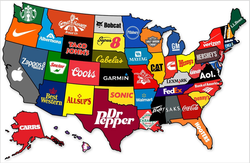
 LIVE GIS Seminar Event #4: Understanding Spatial Data As you know, a new GIS curriculum is taking shape on ConservationTraining; six new courses ranging in topic from the five functions of a GIS to managing your spatial data to creating a map product. One new learning component has been created for each of these new courses, the live seminar event. We are really excited about the LIVE events. The live seminar events will be held via WebEx technology and presented by several of the course authors. Understanding Spatial Data was released about a month ago. The live seminar event for this course will be held next week on Tuesday August 27, 2013 at Noon Eastern Time. This live seminar event will be open to the ConservationTraining community and will consist of demonstrations highlighting functionality discussed within the associated course. The live seminar event will be recorded and posted to the Understanding Spatial Data course room. Make sure to get your “seat” as soon as possible. Click here to see the new course Understanding Spatial Data. Click here to register for the LIVE GIS Seminar Event on August 27, 2013 at Noon Eastern Time.  If you find yourself in Denver, CO, USA on Tuesday Oct 8, 2013 and are interested in learning about “Applied Spatial Statistics Using R and ArcGIS”; then, check this out: http://www.gisintherockies.org/2013-conference/program/workshops/applied-spatial-statistics-using-r-and-arcgis/ The minor fees for this workshop goes to a Student Scholarship fund which is sponsored by the American Society for Photogrammetry and Remote Sensing Rocky Mountain Region.  Any Seinfeld fans out there? This was put together by the New York Times & Hot 97! to show you the comprehensiv and compulsive archive of Seinfeld Geography from across the planet. Fun and entertaining. http://mapsaboutnothing.wordpress.com/  A collection of maps that show the world in ways you may have never seen before! The Red Hair Map, the World According to Americans, Common Surnames, Countries officially using the Metric System, and more. Definitely worth a look. http://www.boredpanda.com/fun-maps-they-didnt-teach-you-in-school/ |
Categories
All
Archives
June 2024
|
 RSS Feed